MyTopo
Clayton Indiana US Topo Map
Couldn't load pickup availability
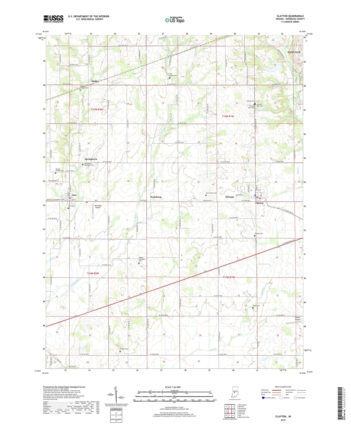
2022 topographic map quadrangle Clayton in the state of Indiana. Scale: 1:24000. Based on the newly updated USGS 7.5' US Topo map series, this map is in the following counties: Hendricks. The map contains contour data, water features, and other items you are used to seeing on USGS maps, but also has updated roads and other features. This is the next generation of topographic maps. Printed on high-quality waterproof paper with UV fade-resistant inks.
Quads adjacent to this one:
West: Coatesville
Northwest: North Salem
North: Danville
Northeast: Brownsburg
East: Plainfield
Southeast: Mooresville West
South: Hall
Southwest: Eminence
This map covers the same area as the classic USGS quad with code o39086f5.
Contains the following named places: Amo, Amo Cemetery, Amo Elementary School, Amo Post Office, Beck Lake, Beck Lake Dam, Bethel Lutheran Cemetery, Breneman Farms, Buescher Farms, Cascade School, Christie East Cemetery, Christie West Cemetery, Clayton, Clayton Cemetery, Clayton Police Department, Clayton Post Office, Cooper Airport, Cox's Plant Farm, Coyote Creek Farms, Danlea Farms, Fire Department of Liberty Township, Gary Alex Farm, Hadley, Hadley Friends Cemetery, Hillside Cemetery, Jones Cemetery, Marcidale Airport, McCormack Cemetery, Mill Creek Cemetery, Mill Creek Church, Mill Creek East Elementary School, Mill Creek Fire Department Station 51, Nash, New Mill Creek Cemetery, Pecksburg, Snoddy Cemetery, Spring Friends Cemetery, Springtown, Springtown Methodist Cemetery, Summit, Sunny Slope Farm, Town of Amo, Town of Clayton, Township of Clay, Township of Franklin, Township of Liberty, ZIP Codes: 46103, 46118