MyTopo
Eminence Indiana US Topo Map
Couldn't load pickup availability
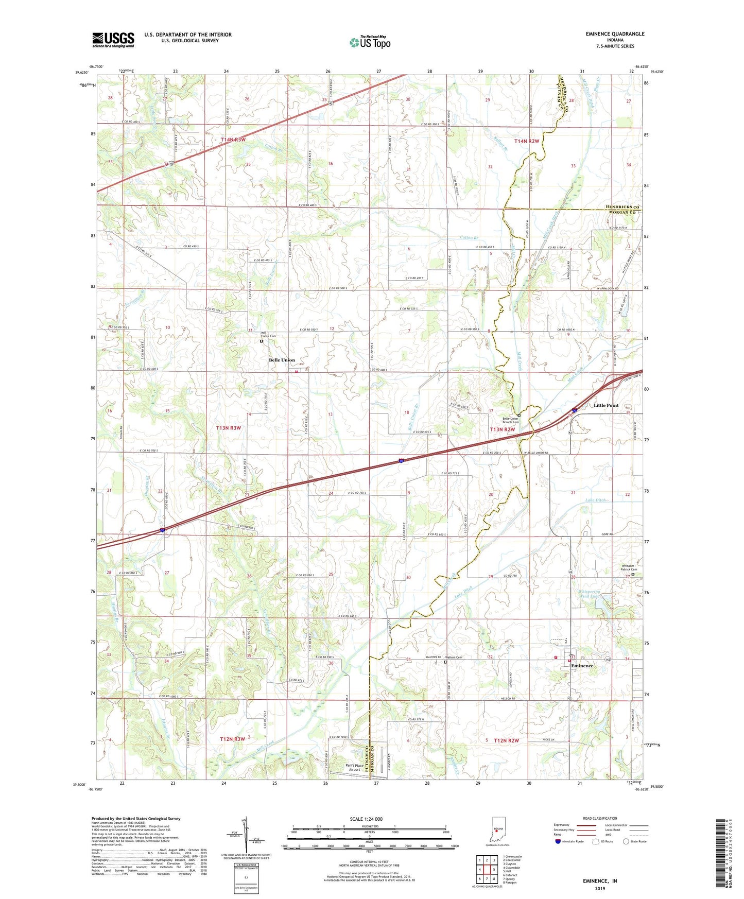
2022 topographic map quadrangle Eminence in the state of Indiana. Scale: 1:24000. Based on the newly updated USGS 7.5' US Topo map series, this map is in the following counties: Putnam, Morgan, Hendricks. The map contains contour data, water features, and other items you are used to seeing on USGS maps, but also has updated roads and other features. This is the next generation of topographic maps. Printed on high-quality waterproof paper with UV fade-resistant inks.
Quads adjacent to this one:
West: Cloverdale
Northwest: Greencastle
North: Coatesville
Northeast: Clayton
East: Hall
Southeast: Paragon
South: Quincy
Southwest: Cataract
This map covers the same area as the classic USGS quad with code o39086e6.
Contains the following named places: A and A Township Fire Station 11, A and A Township Volunteer Fire Department, A and A Township Volunteer Fire Department Station 2, Belle Union, Belle Union Branch, Belle Union Branch Cemetery, Belle Union Elementary School, Board Park, Broad Park, Cotton Branch, Eminence, Eminence Consolidated School, Eminence Post Office, Jefferson Township Volunteer Fire Department, Little Point, Mill Creek Cemetery, Mill Creek Ditch, Mud Creek, Pam's Place Airport, Plum Creek, Rhodes Creek, Sallust Branch, Township of Jefferson, Tri-County Community Church, Union Branch, Union Valley Church, Vermillion Branch, Walnut Chapel, Walters Cemetery, Whispering Wind Lake, Whispering Wind Lake Dam, Whitaker - Patrick Cemetery, ZIP Code: 46125