MyTopo
Coatesville Indiana US Topo Map
Couldn't load pickup availability
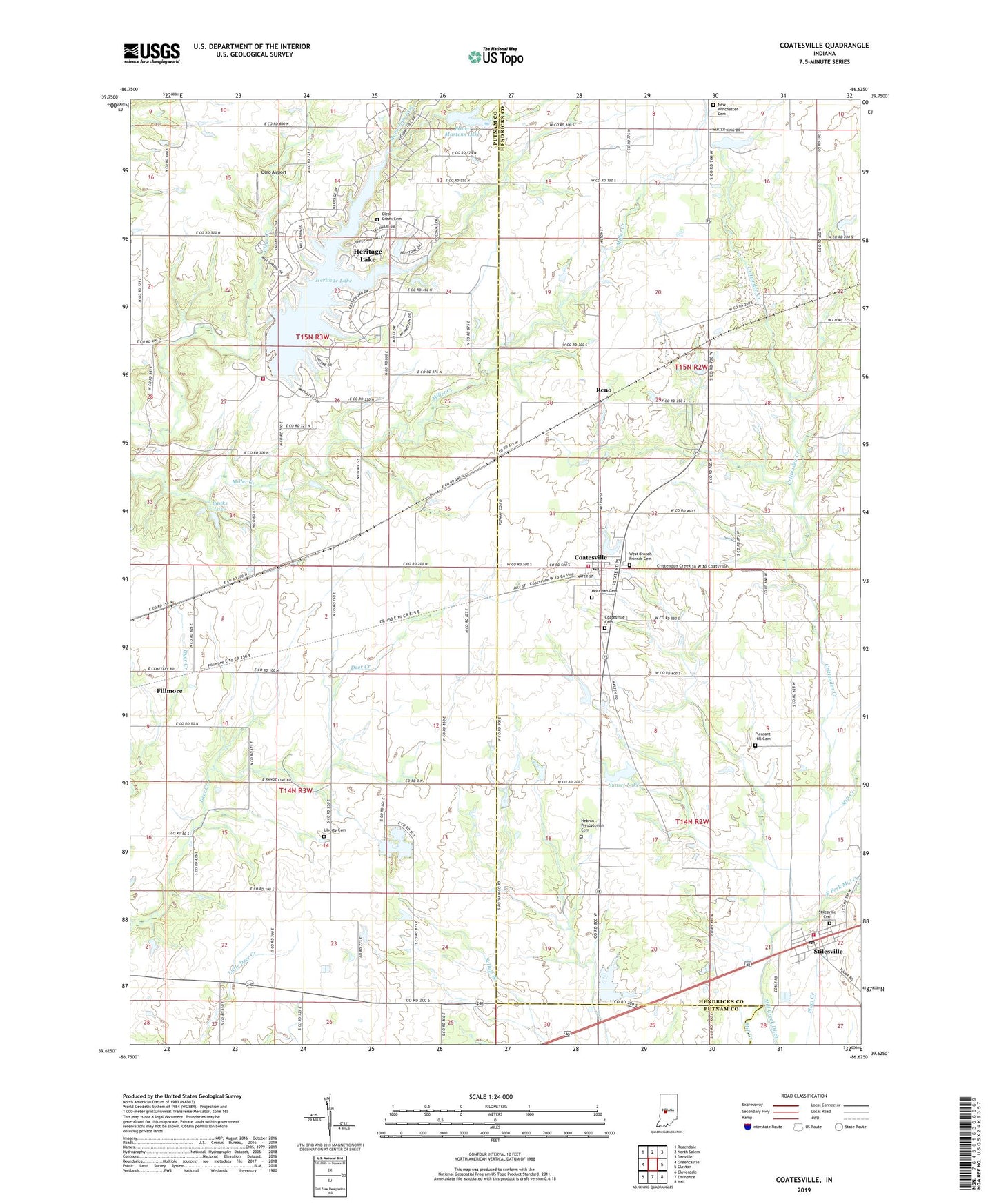
2022 topographic map quadrangle Coatesville in the state of Indiana. Scale: 1:24000. Based on the newly updated USGS 7.5' US Topo map series, this map is in the following counties: Hendricks, Putnam. The map contains contour data, water features, and other items you are used to seeing on USGS maps, but also has updated roads and other features. This is the next generation of topographic maps. Printed on high-quality waterproof paper with UV fade-resistant inks.
Quads adjacent to this one:
West: Greencastle
Northwest: Roachdale
North: North Salem
Northeast: Danville
East: Clayton
Southeast: Hall
South: Eminence
Southwest: Cloverdale
This map covers the same area as the classic USGS quad with code o39086f6.
Contains the following named places: Banks Lake, Banks Lake Dam, Bethel Church, Canaan Church, Clear Creek Cemetery, Coatesville, Coatesville Cemetery, Coatesville Post Office, Crittenden Creek, East Fork Mill Creek, Elmer Martens Lake, Elmer Martens Lake Dam, Floyd Township Fire and Rescue, Hebron Presbyterian Cemetery, Heritage Lake, Heritage Lake Census Designated Place, Heritage Lake Dam, Liberty Cemetery, Malta Station Post Office, Mill Creek Ditch, Mill Creek Fire Department Station 161, Mill Creek Fire Department Station 71, Monachals Fork, Moravian Cemetery, New Winchester Cemetery, Oleo Airport, Pleasant Hill Cemetery, Reno, Stilesville, Stilesville Cemetery, Stilesville Elementary School, Stilesville Post Office, Sunset Lake, Sunset Lake Dam, Town of Coatesville, Town of Stilesville, Township of Floyd, Township of Marion, Vaughn Airport, West Branch Friends Cemetery, ZIP Codes: 46121, 46128