MyTopo
Cloverdale Indiana US Topo Map
Couldn't load pickup availability
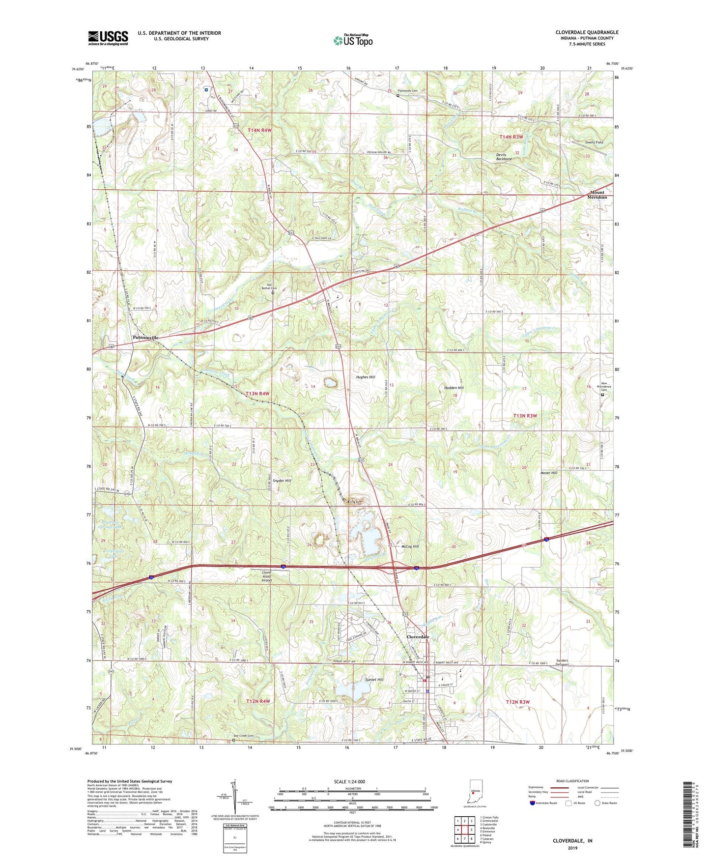
2022 topographic map quadrangle Cloverdale in the state of Indiana. Scale: 1:24000. Based on the newly updated USGS 7.5' US Topo map series, this map is in the following counties: Putnam. The map contains contour data, water features, and other items you are used to seeing on USGS maps, but also has updated roads and other features. This is the next generation of topographic maps. Printed on high-quality waterproof paper with UV fade-resistant inks.
Quads adjacent to this one:
West: Reelsville
Northwest: Clinton Falls
North: Greencastle
Northeast: Coatesville
East: Eminence
Southeast: Quincy
South: Cataract
Southwest: Poland
This map covers the same area as the classic USGS quad with code o39086e7.
Contains the following named places: Clover Knoll Airport, Cloverdale, Cloverdale Elementary School, Cloverdale Junior/Senior High School, Cloverdale Police Department, Cloverdale Post Office, Cloverdale Quarry, Cloverdale Township Volunteer Fire Department, Cradick Corner, Deer Creek Church, Devils Backbone, Doe Creek Cemetery, Dogwood Springs Lake, Dogwood Springs Lake Dam, Flatwoods Cemetery, Greyhound Lake, Greyhound Lake Dam, Hadden Hill, Hughes Hill, Limedale Quarry, Limestone Creek, Little Deer Creek, Lower Limestone Creek, McCoy Hill, Moser Hill, Mount Meridian, New Providence Cemetery, Old Bethel Cemetery, Owens Field, Owl Branch, Putnam County Hospital, Putnam County Operation Life - Cloverdale Substation, Putnam County Stone Pit, Putnamville, Rabbit Run, Sanders Gyroport, Snyder Hill, South Putnam High School, Sunset Hill, Town of Cloverdale, Township of Cloverdale, Township of Warren, Upper Limestone Creek, Wallace Branch, Westland, ZIP Code: 46120