MyTopo
Colfax Indiana US Topo Map
Couldn't load pickup availability
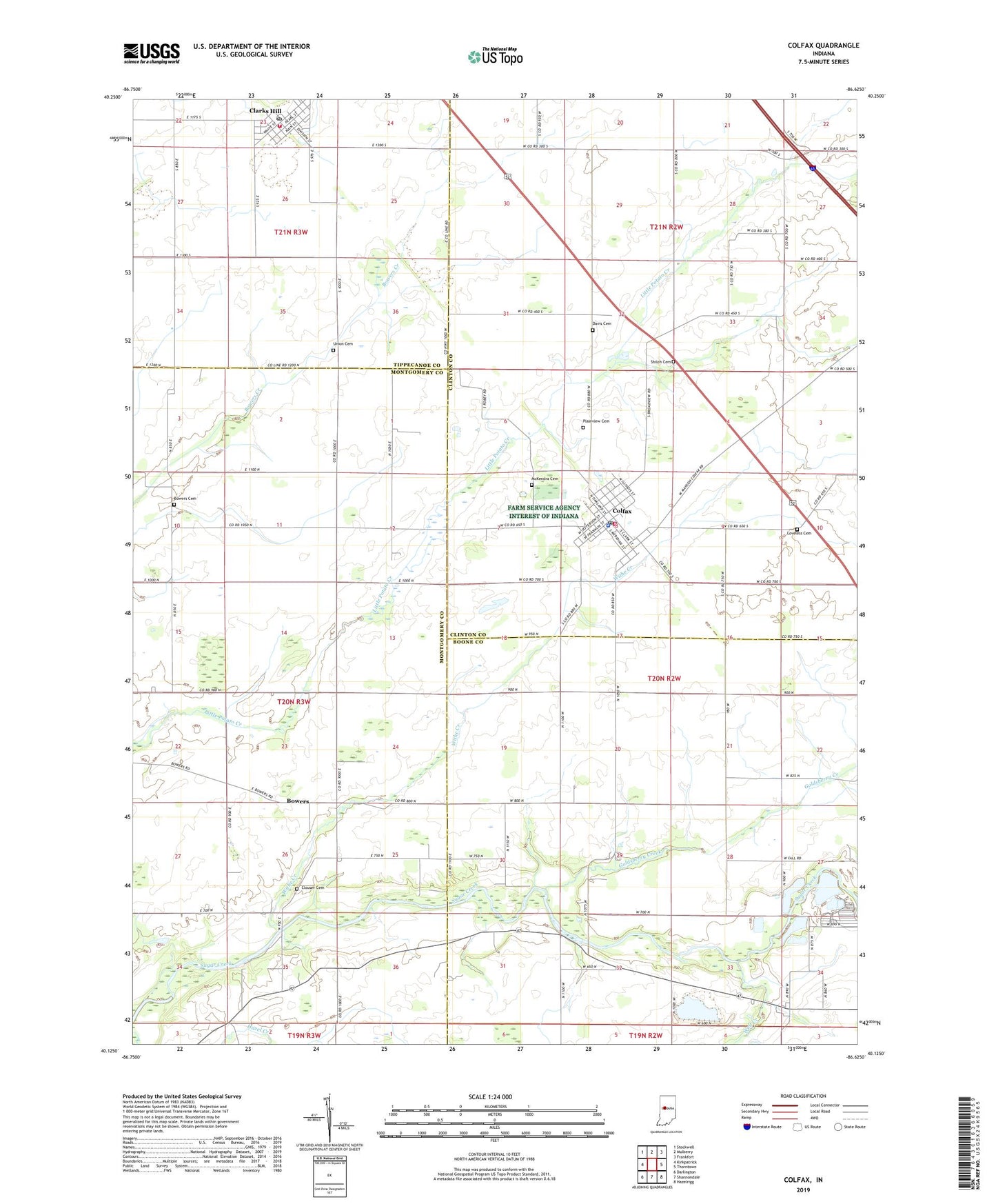
2022 topographic map quadrangle Colfax in the state of Indiana. Scale: 1:24000. Based on the newly updated USGS 7.5' US Topo map series, this map is in the following counties: Boone, Clinton, Montgomery, Tippecanoe. The map contains contour data, water features, and other items you are used to seeing on USGS maps, but also has updated roads and other features. This is the next generation of topographic maps. Printed on high-quality waterproof paper with UV fade-resistant inks.
Quads adjacent to this one:
West: Kirkpatrick
Northwest: Stockwell
North: Mulberry
Northeast: Frankfort
East: Thorntown
Southeast: Hazelrigg
South: Shannondale
Southwest: Darlington
This map covers the same area as the classic USGS quad with code o40086b6.
Contains the following named places: Bowers, Bowers Cemetery, Clarks Hill, Clarks Hill Elementary School, Clarks Hill Post Office, Clarks Hill Volunteer Fire Department, Clouser Cemetery, Colfax, Colfax Community Emergency Medical Services, Colfax Police Department, Colfax Post Office, Davis Cemetery, Goldsberry Creek, Hazel Creek, Lauramie Township Emergency Medical Services, Loveless Cemetery, McKendra Cemetery, Perry Township Colfax Fire Department, Plainview Cemetery, Plainview Church, Shiloh Cemetery, Town of Clarks Hill, Town of Colfax, Township of Perry, Township of Sugar Creek, Union Cemetery, Withe Creek, Wolf Creek, ZIP Codes: 46035, 47930