MyTopo
Frankfort Indiana US Topo Map
Couldn't load pickup availability
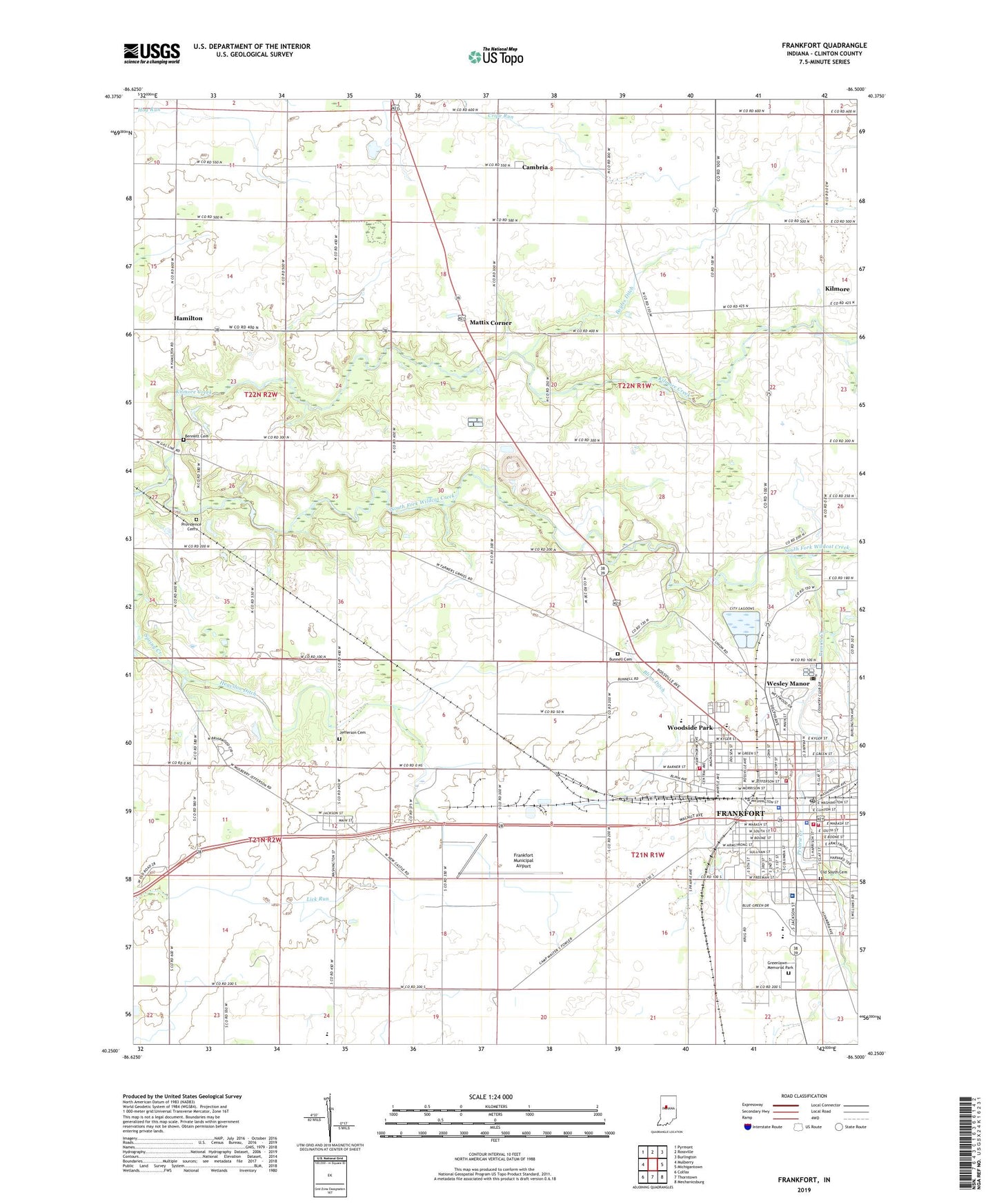
2022 topographic map quadrangle Frankfort in the state of Indiana. Scale: 1:24000. Based on the newly updated USGS 7.5' US Topo map series, this map is in the following counties: Clinton. The map contains contour data, water features, and other items you are used to seeing on USGS maps, but also has updated roads and other features. This is the next generation of topographic maps. Printed on high-quality waterproof paper with UV fade-resistant inks.
Quads adjacent to this one:
West: Mulberry
Northwest: Pyrmont
North: Rossville
Northeast: Burlington
East: Michigantown
Southeast: Mechanicsburg
South: Thorntown
Southwest: Colfax
This map covers the same area as the classic USGS quad with code o40086c5.
Contains the following named places: Bennett Cemetery, Blinn Ditch, Boyles Ditch, Bunnell Cemetery, Cambria, Camp Walter S Fowler, City of Frankfort, Clinton County Emergency Medical Services - Ambulance 58, Clinton County Landfill, Clinton County Sheriff's Office, Clinton Prairie Junior-Senior High School, Dorner Park, Ellis, Frankfort, Frankfort Fire Department Headquarters, Frankfort Fire Department Station 2, Frankfort Fire Department Station 3, Frankfort Fire Department Storage Unit, Frankfort Junior High School, Frankfort Municipal Airport, Frankfort Police Department, Frankfort Post Office, Frankfort Senior High School, Friedrich Airport, Gem City Park, Greenlawn Memorial Park, Hamilton, Heavilon Ditch, IU Health Frankfort Hospital, Jefferson, Jefferson Cemetery, Kilmore, Kilmore Creek, Lick Run, Lincoln Elementary School, Mattix Corner, Old South Cemetery, Pleasant Hill Church, Prairie Creek, Providence Cemetery, Saint Luke Church, Saint Marys School, Samuel P Kyger Elementary School, South Side Elementary School, Township of Union, Township of Washington, Wesley Manor, Woodside Elementary School, Woodside Park, Zollers Airport