MyTopo
Shannondale Indiana US Topo Map
Couldn't load pickup availability
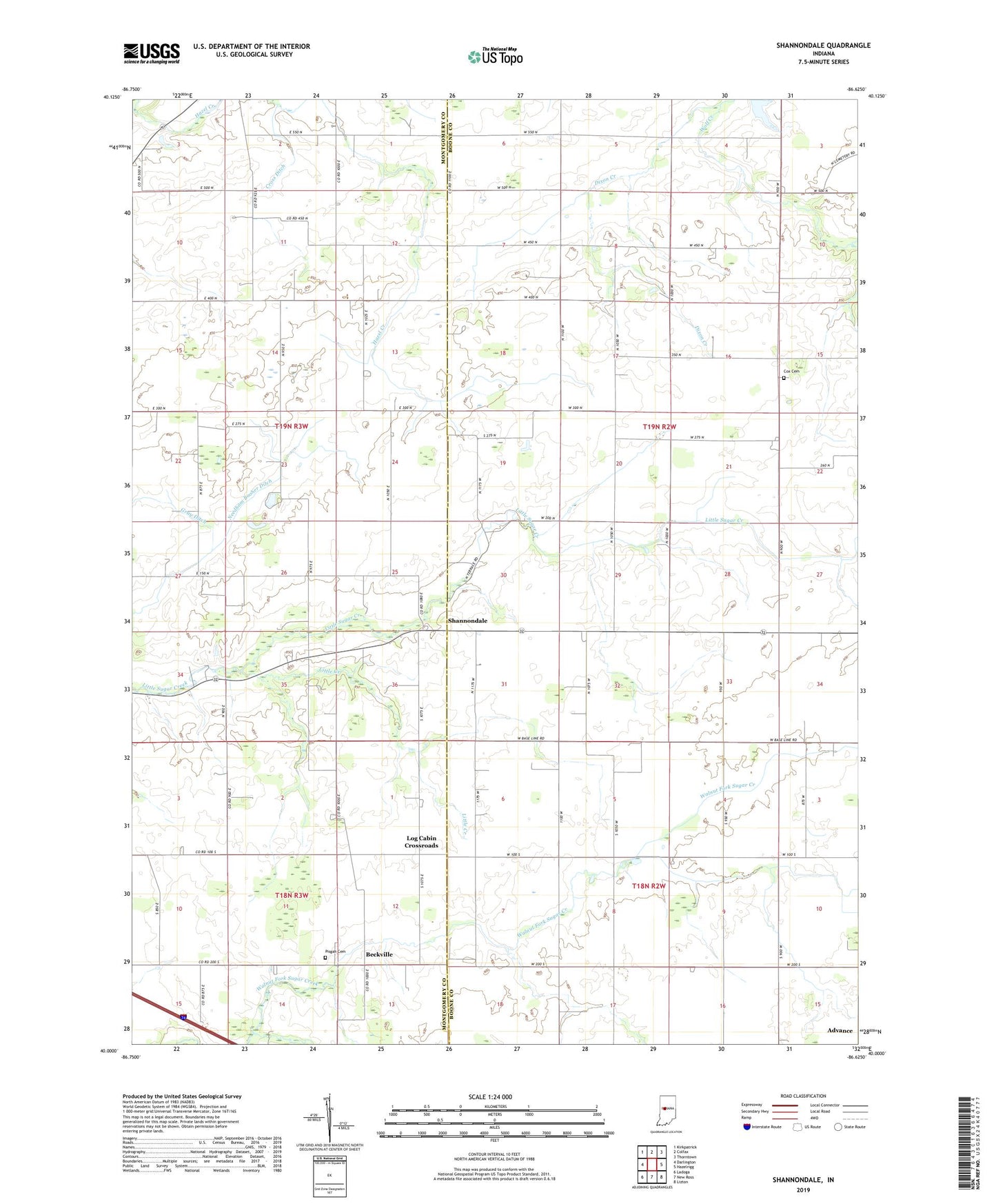
2022 topographic map quadrangle Shannondale in the state of Indiana. Scale: 1:24000. Based on the newly updated USGS 7.5' US Topo map series, this map is in the following counties: Boone, Montgomery. The map contains contour data, water features, and other items you are used to seeing on USGS maps, but also has updated roads and other features. This is the next generation of topographic maps. Printed on high-quality waterproof paper with UV fade-resistant inks.
Quads adjacent to this one:
West: Darlington
Northwest: Kirkpatrick
North: Colfax
Northeast: Thorntown
East: Hazelrigg
Southeast: Lizton
South: New Ross
Southwest: Ladoga
This map covers the same area as the classic USGS quad with code o40086a6.
Contains the following named places: Beckville, Cox Cemetery, Cross Ditch, Dixon Creek, Gray Ditch, Little Creek, Log Cabin Crossroads, Needham Booher Ditch, Pennington Lake, Pisgah Cemetery, Providence Church, Saint James Church, Shannondale, Walnut Grove Church, ZIP Code: 47940