MyTopo
Thorntown Indiana US Topo Map
Couldn't load pickup availability
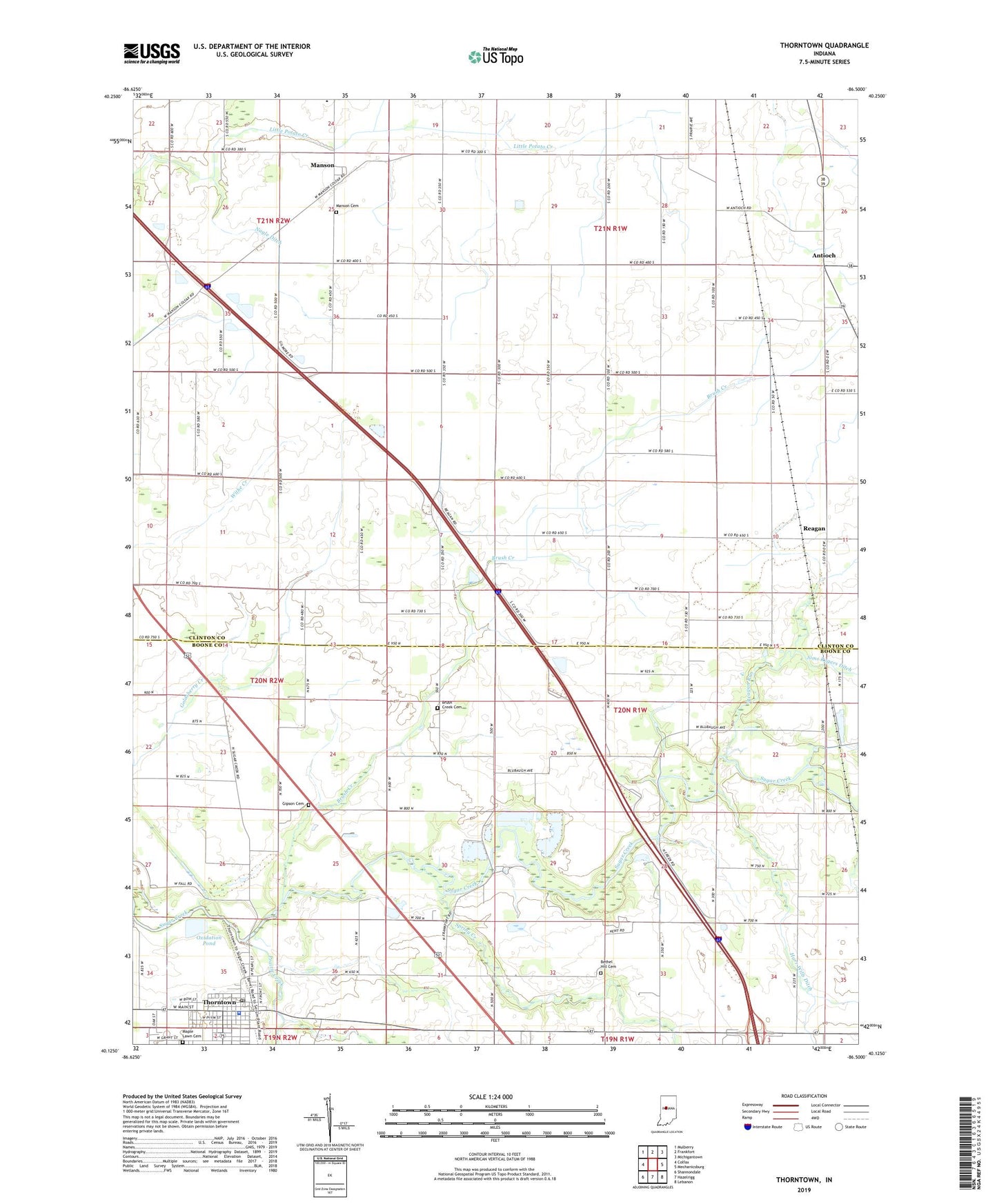
2022 topographic map quadrangle Thorntown in the state of Indiana. Scale: 1:24000. Based on the newly updated USGS 7.5' US Topo map series, this map is in the following counties: Boone, Clinton. The map contains contour data, water features, and other items you are used to seeing on USGS maps, but also has updated roads and other features. This is the next generation of topographic maps. Printed on high-quality waterproof paper with UV fade-resistant inks.
Quads adjacent to this one:
West: Colfax
Northwest: Mulberry
North: Frankfort
Northeast: Michigantown
East: Mechanicsburg
Southeast: Lebanon
South: Hazelrigg
Southwest: Shannondale
This map covers the same area as the classic USGS quad with code o40086b5.
Contains the following named places: Antioch, Bethel Hill Cemetery, Brush Creek, Brush Creek Cemetery, Clark Airport, Garden Park, Gipson Cemetery, Harr Wills Ditch, Kinder Church, Manson, Manson Cemetery, Maple Lawn Cemetery, Midstate Aggregate Pit, Nagle Ditch, New Hope Church, Oxidation Pond, Pleasant Hill Church, Prairie Creek, Reagan, Reagan Run, Spring Creek, Thorntown, Thorntown Police Department, Thorntown Post Office, Town of Thorntown, Township of Jackson, Township of Washington