MyTopo
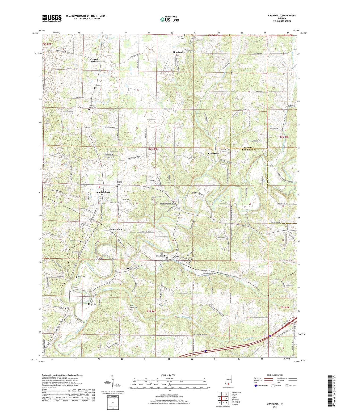
Crandall Indiana US Topo Map
Couldn't load pickup availability
2022 topographic map quadrangle Crandall in the state of Indiana. Scale: 1:24000. Based on the newly updated USGS 7.5' US Topo map series, this map is in the following counties: Harrison, Floyd. The map contains contour data, water features, and other items you are used to seeing on USGS maps, but also has updated roads and other features. This is the next generation of topographic maps. Printed on high-quality waterproof paper with UV fade-resistant inks.
Quads adjacent to this one:
West: Depauw
Northwest: Fredericksburg
North: Palmyra
Northeast: Borden
East: Georgetown
Southeast: Lanesville
South: Corydon East
Southwest: Corydon West
This map covers the same area as the classic USGS quad with code o38086c1.
Contains the following named places: Bethlehem Cemetery, Bradford, Byrne Field, Byrneville, Carr Cemetery, Central Barren, Central Barren Cemetery, Conrad Cemetery, Corn Creek, Corydon Junction, Crandall, Crandall Branch, Crandall Post Office, Flock Family Cemetery, Floyd Country Conservation Club, Georgetown Creek, German Methodist Cemetery, Hurst Cemetery, Hurstown Church, Indian Creek Church, Kaylor Cemetery, Mott Station, New Salisbury, New Salisbury Census Designated Place, New Salisbury Post Office, Old German Church, Raccoon Branch, Ramsey Volunteer Fire Department Station 2, Richland Creek, Saint John Church, Saint Michael Church, Saint Paulus Church, Sappenfield Cemetery, Town of Crandall, Township of Jackson, Wagner Cemetery, Zoar Church, ZIP Codes: 47114, 47124, 47161