MyTopo
Palmyra Indiana US Topo Map
Couldn't load pickup availability
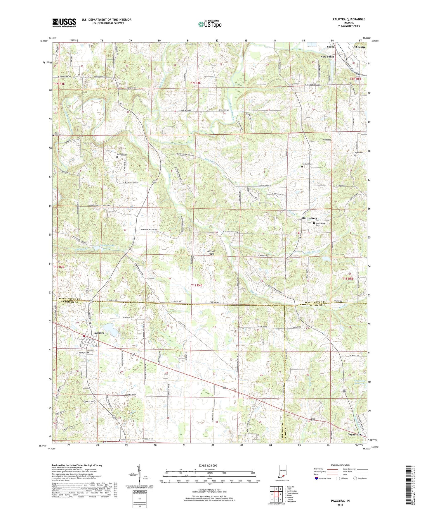
2022 topographic map quadrangle Palmyra in the state of Indiana. Scale: 1:24000. Based on the newly updated USGS 7.5' US Topo map series, this map is in the following counties: Washington, Harrison, Floyd. The map contains contour data, water features, and other items you are used to seeing on USGS maps, but also has updated roads and other features. This is the next generation of topographic maps. Printed on high-quality waterproof paper with UV fade-resistant inks.
Quads adjacent to this one:
West: Fredericksburg
Northwest: Becks Mill
North: Salem
Northeast: South Boston
East: Borden
Southeast: Georgetown
South: Crandall
Southwest: Depauw
This map covers the same area as the classic USGS quad with code o38086d1.
Contains the following named places: Bear Creek, Bethlehem Church, Big Springs Church, Crusade School, David Voyles Cemetery, Dutch Creek, Goss Cemetery, Greenville Water Supply Dam, Hiestand Cemetery, Jackson Township Fire Department, Little Bear Creek, Martinsburg, Martinsburg Cemetery, Morgan Elementary School, Mount Washington Church, Old Pekin, Palmyra, Palmyra Cemetery, Palmyra Fire Department, Palmyra Lake, Palmyra Post Office, Palmyra Volunteer Fire Department, Punch Run, Rickard Cemetery, Shorts Corner, Snyders Chapel, South Liberty Church, Town of Palmyra, Township of Jackson, Township of Morgan, Vincennes Trail, ZIP Code: 47164