MyTopo
Depauw Indiana US Topo Map
Couldn't load pickup availability
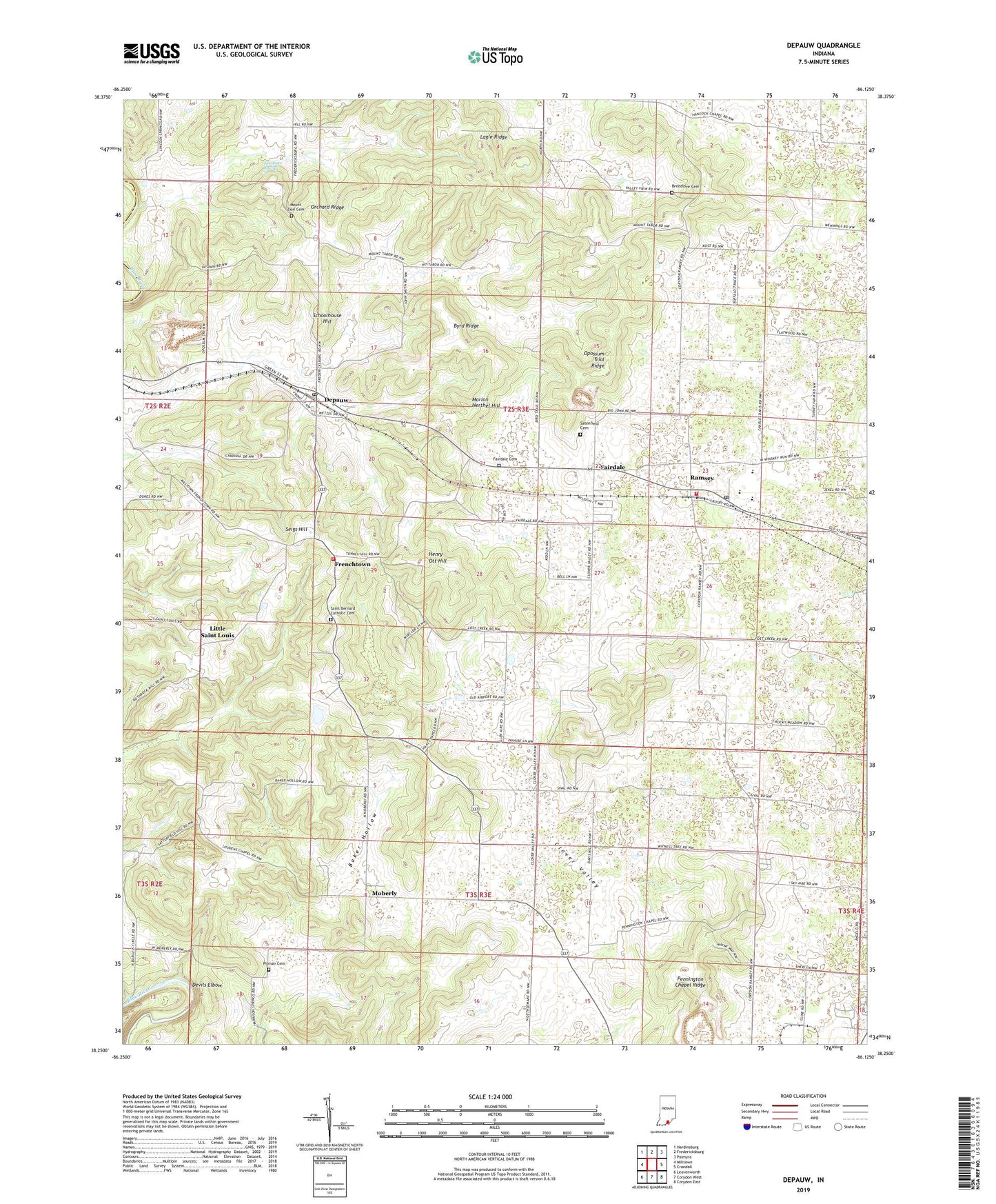
2022 topographic map quadrangle Depauw in the state of Indiana. Scale: 1:24000. Based on the newly updated USGS 7.5' US Topo map series, this map is in the following counties: Harrison, Crawford. The map contains contour data, water features, and other items you are used to seeing on USGS maps, but also has updated roads and other features. This is the next generation of topographic maps. Printed on high-quality waterproof paper with UV fade-resistant inks.
Quads adjacent to this one:
West: Milltown
Northwest: Hardinsburg
North: Fredericksburg
Northeast: Palmyra
East: Crandall
Southeast: Corydon East
South: Corydon West
Southwest: Leavenworth
This map covers the same area as the classic USGS quad with code o38086c2.
Contains the following named places: Baker Hollow, Blue River Church, Breedlove Cemetery, Byrd Ridge, Clover Valley, Corydon Stone Quarry, Depauw, Depauw Post Office, Devils Elbow, Fairdale, Fairdale Cemetery, Frenchtown, Glen-Hire Ranch Airport, Haas Chapel, Henry Ott Hill, Lagle Ridge, Leichner Spring, Little Saint Louis, Loudens Chapel, Marion Herthel Hill, Milltown Rock Quarry, Moberly, Mount Tabor Church, Mount Zion Cemetery, North Central School, Opossum Trial Ridge, Orchard Ridge, Pennington Chapel, Pennington Chapel Ridge, Pitman Cemetery, Ramsey, Ramsey Post Office, Ramsey Volunteer Fire Department Station 1, Ramsey Volunteer Fire Department Station 3, Saint Bernard Catholic Cemetery, Saint Bernards Church, Satenfield Cemetery, Schoolhouse Hill, Seigs Hill, Township of Spencer, Woods Chapel, ZIP Codes: 47115, 47166