MyTopo
Delphi Indiana US Topo Map
Couldn't load pickup availability
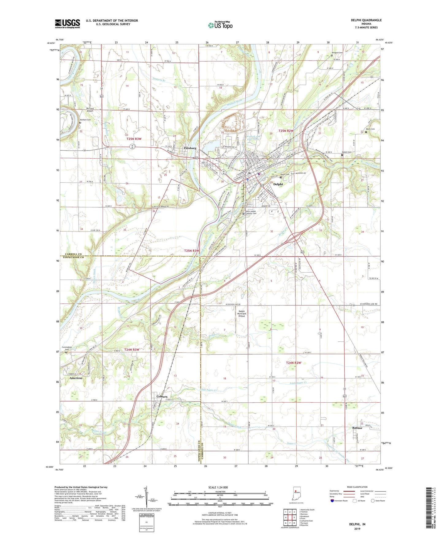
2022 topographic map quadrangle Delphi in the state of Indiana. Scale: 1:24000. Based on the newly updated USGS 7.5' US Topo map series, this map is in the following counties: Carroll, Tippecanoe. The map contains contour data, water features, and other items you are used to seeing on USGS maps, but also has updated roads and other features. This is the next generation of topographic maps. Printed on high-quality waterproof paper with UV fade-resistant inks.
Quads adjacent to this one:
West: Brookston
Northwest: Monticello South
North: Yeoman
Northeast: Burrows
East: Flora
Southeast: Rossville
South: Pyrmont
Southwest: Lafayette East
This map covers the same area as the classic USGS quad with code o40086e6.
Contains the following named places: Americus Census Designated Place, Baum Cemetery, Benham Cemetery, Bowen Ditch, Bridge Creek, Carroll County Sheriff's Office, City of Delphi, Colburn, Colburn Census Designated Place, Cunningham Cemetery, De Ford Airport, Deer Creek, Delphi, Delphi Cemetery, Delphi Courthouse Square Historic District, Delphi Limestone Quarry, Delphi Municipal Airport, Delphi Police Department, Delphi Post Office, Delphi Tri - Township Fire Department, Gray Turkey Farms, Harley, Harley Siding, Hillcrest Elementary School, Julien Ditch, Little Sugar Creek, Mears Cemetery, New Hope School, Pittsburg, Pleasant Run, Radnor, Robinson Branch, Saint Joseph Catholic Cemetery, Sugar Creek, Sugar Creek Branch Number One, Tannery Branch, Township of Deer Creek, Township of Madison, Township of Tippecanoe, Township of Washington, Wabash and Erie Canal, Wingard Cemetery, ZIP Code: 46923