MyTopo
Rossville Indiana US Topo Map
Couldn't load pickup availability
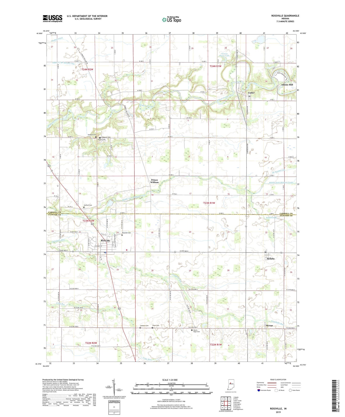
2022 topographic map quadrangle Rossville in the state of Indiana. Scale: 1:24000. Based on the newly updated USGS 7.5' US Topo map series, this map is in the following counties: Carroll, Clinton. The map contains contour data, water features, and other items you are used to seeing on USGS maps, but also has updated roads and other features. This is the next generation of topographic maps. Printed on high-quality waterproof paper with UV fade-resistant inks.
Quads adjacent to this one:
West: Pyrmont
Northwest: Delphi
North: Flora
Northeast: Deer Creek
East: Burlington
Southeast: Michigantown
South: Frankfort
Southwest: Mulberry
This map covers the same area as the classic USGS quad with code o40086d5.
Contains the following named places: Adams Mill, Branch Number Six, Cutler, Cutler Post Office, Gray Field, Hiner Cemetery, Hufford Cemetery, Hughes Cemetery, Latshaw Cemetery, Moran, Mount Hope Cemetery, Mount Olivet Church, Prince William, Ray, Robinson Branch, Rossville, Rossville Cemetery, Rossville Police Department, Rossville Post Office, Rossville Volunteer Ambulance Service, Rossville Volunteer Fire Department, Sedalia, Sedalia Post Office, Shaffer Ditch, Town of Rossville, Township of Democrat, Township of Owen, Township of Ross, Vernon Payne Lake, Vernon Payne Lake Dam, Wagoner Cemetery, WLFI-TV (Lafayette), ZIP Code: 46065