MyTopo
Pyrmont Indiana US Topo Map
Couldn't load pickup availability
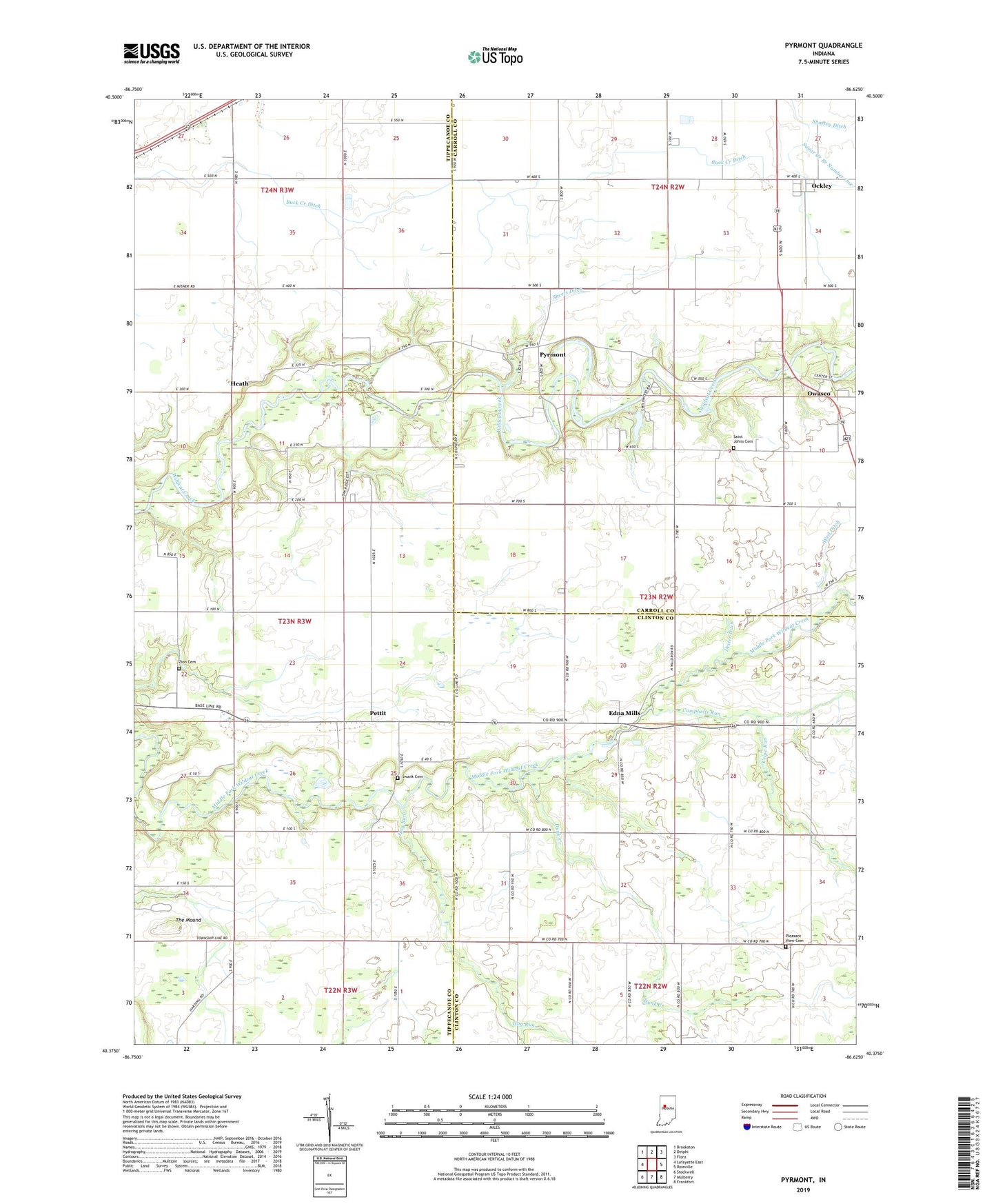
2022 topographic map quadrangle Pyrmont in the state of Indiana. Scale: 1:24000. Based on the newly updated USGS 7.5' US Topo map series, this map is in the following counties: Tippecanoe, Carroll, Clinton. The map contains contour data, water features, and other items you are used to seeing on USGS maps, but also has updated roads and other features. This is the next generation of topographic maps. Printed on high-quality waterproof paper with UV fade-resistant inks.
Quads adjacent to this one:
West: Lafayette East
Northwest: Brookston
North: Delphi
Northeast: Flora
East: Rossville
Southeast: Frankfort
South: Mulberry
Southwest: Stockwell
This map covers the same area as the classic USGS quad with code o40086d6.
Contains the following named places: Barnhart Strip Airport, Bethel Church, Buck Creek Ditch, Campbells Run, Cripe Run, Deiter Ditch, Dunk Creek, Edna Mills, Fairview Church, Heath, Hog Run, Ockley, Owasco, Oxford Church, Pettit, Pleasant View Cemetery, Pyrmont, Saint Johns Cemetery, Schimnel Ditch, Shaftey Ditch, Sheets Ditch, Swank Cemetery, Sycamore Valley Camp, The Mound, Township of Clay, Weil Ditch, Zion Cemetery