MyTopo
Yeoman Indiana US Topo Map
Couldn't load pickup availability
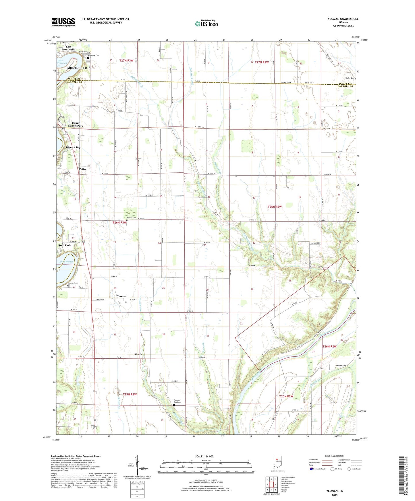
2023 topographic map quadrangle Yeoman in the state of Indiana. Scale: 1:24000. Based on the newly updated USGS 7.5' US Topo map series, this map is in the following counties: Carroll, White. The map contains contour data, water features, and other items you are used to seeing on USGS maps, but also has updated roads and other features. This is the next generation of topographic maps. Printed on high-quality waterproof paper with UV fade-resistant inks.
Quads adjacent to this one:
West: Monticello South
Northwest: Monticello North
North: Idaville
Northeast: Burnettsville
East: Burrows
Southeast: Flora
South: Delphi
Southwest: Brookston
This map covers the same area as the classic USGS quad with code o40086f6.
Contains the following named places: Beck Ward Ditch, Bostetter Cemetery, Hardy Ditch, Hickory Grove Church, Lake Freeman, Mitchell Creek, Oak Grove Church, O'Farrell Hog Farm, Patton, Pleasant Run Cemetery, Riverview Cemetery, Roth Park, Schock Cemetery, Sleeth, Squaw Branch, Terrace Bay, Town of Yeoman, Township of Jefferson, Yeoman, Yeoman Cemetery, Yeoman Elementary School, ZIP Code: 47997