MyTopo
Edinburgh Indiana US Topo Map
Couldn't load pickup availability
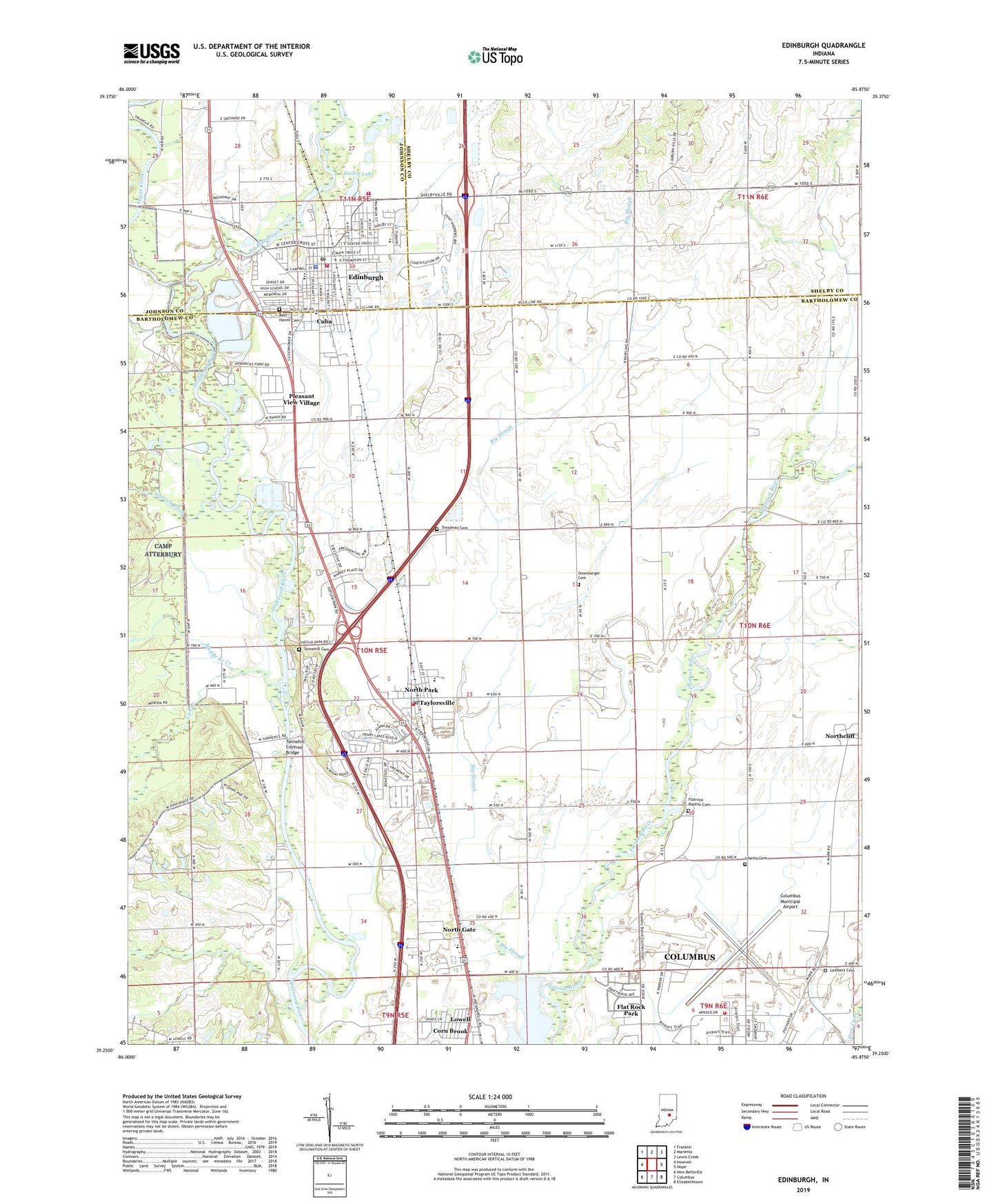
2022 topographic map quadrangle Edinburgh in the state of Indiana. Scale: 1:24000. Based on the newly updated USGS 7.5' US Topo map series, this map is in the following counties: Bartholomew, Shelby, Johnson. The map contains contour data, water features, and other items you are used to seeing on USGS maps, but also has updated roads and other features. This is the next generation of topographic maps. Printed on high-quality waterproof paper with UV fade-resistant inks.
Quads adjacent to this one:
West: Nineveh
Northwest: Franklin
North: Marietta
Northeast: Lewis Creek
East: Hope
Southeast: Elizabethtown
South: Columbus
Southwest: New Bellsville
This map covers the same area as the classic USGS quad with code o39085c8.
Contains the following named places: Atterbury Army Air Field, Big Blue River, Big Slough, Columbus Fire Department Station 2, Columbus Municipal Airport, Cuba, Dailey Lake, Edinburgh, Edinburgh Fire and Rescue Station 1, Edinburgh Fire and Rescue Station 2, Edinburgh Police Department, Edinburgh Post Office, Flat Rock Park, Flatrock Baptist Cemetery, German Township Volunteer Fire Department, Irwin Park, Lambert Cemetery, Liberty Cemetery, Lick Creek, Lowell, Muddy Branch Creek, New Hope Church, Nineveh Creek, North Gate, North Park, Northcliff, Old Bethel Church, Old Union Church, Pleasant View Village, Rest Haven Cemetery, Saint Georges Church, Steenbarger Cemetery, Sugar Creek, Tannehill Cemetery, Tannehill Covered Bridge, Taylorsville, Taylorsville Census Designated Place, Taylorsville Elementary School, Taylorsville Post Office, Town of Edinburgh, Township of German, Treadway Cemetery, ZIP Codes: 46124, 47280