MyTopo
New Bellsville Indiana US Topo Map
Couldn't load pickup availability
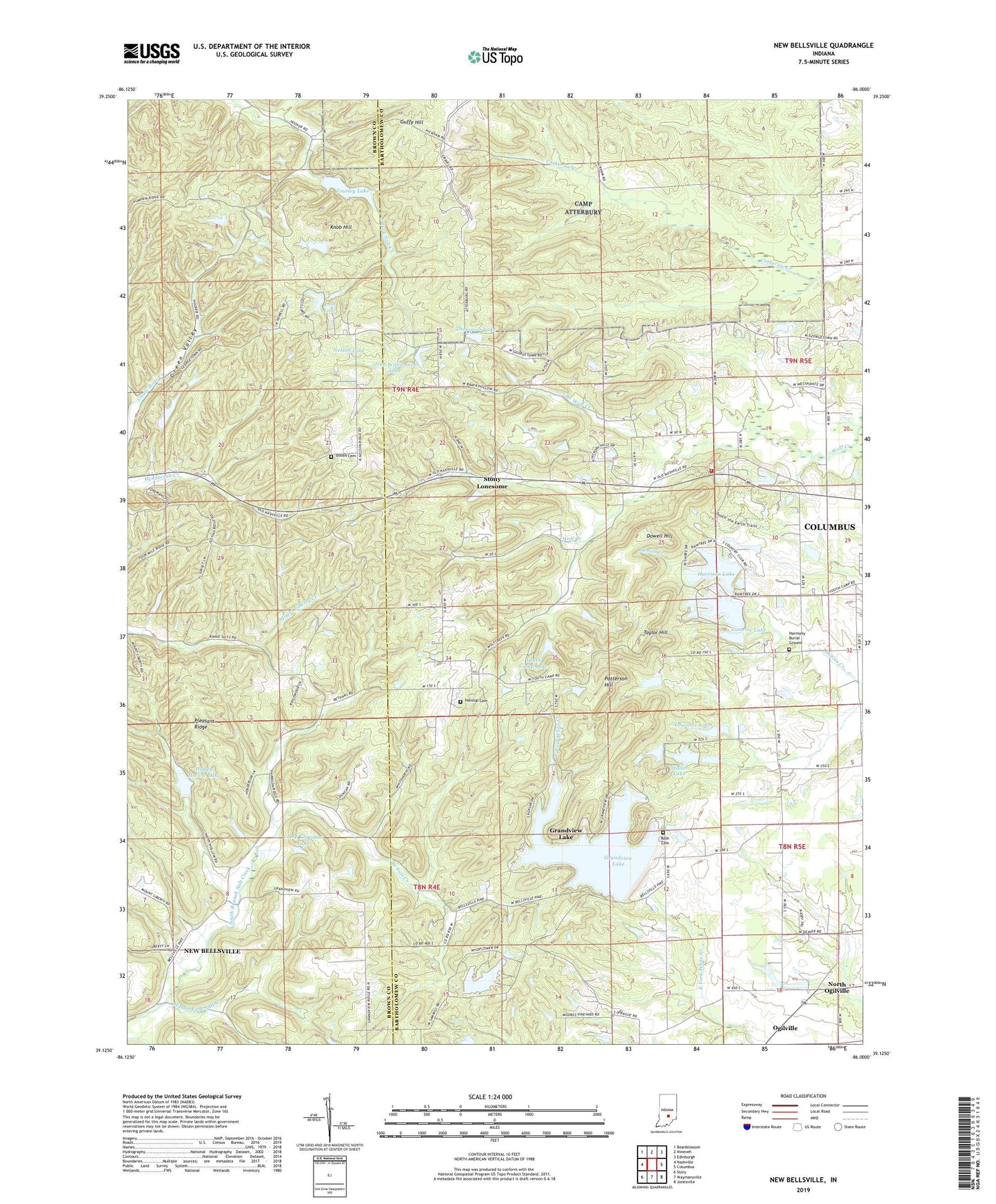
2022 topographic map quadrangle New Bellsville in the state of Indiana. Scale: 1:24000. Based on the newly updated USGS 7.5' US Topo map series, this map is in the following counties: Bartholomew, Brown. The map contains contour data, water features, and other items you are used to seeing on USGS maps, but also has updated roads and other features. This is the next generation of topographic maps. Printed on high-quality waterproof paper with UV fade-resistant inks.
Quads adjacent to this one:
West: Nashville
Northwest: Beanblossom
North: Nineveh
Northeast: Edinburgh
East: Columbus
Southeast: Jonesville
South: Waymansville
Southwest: Story
This map covers the same area as the classic USGS quad with code o39086b1.
Contains the following named places: Bethany, Camp Christina, Camp Christina Lake, Camp Christina Lake Dam, Dobbs Cemetery, Dowell Hill, Grandview Dam, Grandview Lake, Guffy Hill, Haislup Cemetery, Happy Hollow Camp, Happy Hollow Lake, Harmony Burial Ground, Harrison Lake, Harrison Lake Country Club, Harrison North Lake Dam, Harrison South Lake Dam, Harrison Township Volunteer Fire Department, Hurricane Creek, Jean Williamson Lake, Jean Williamson Lake Dam, Knob Hill, Lake on the Green, Lawsons Lake, Lawsons Lake Dam, Lost Lake, Mount Carmel Church, Mount Olive Church, Nelson Lake, New Zion Church, North Branch Wolf Creek, North Harrison Lake, North Ogilville, North Salem Church, Ogilville, Patterson Hill, Pleasant Ridge, Roth Cemetery, Shiloh Church, South Branch Salt Creek, South Harrison Lake, Staller Lake, Staller Lake Dam, Stony Lonesome, Stratford, Tamerix Lake, Tamerix Lake Dam, Taylor Hill, Thompson Lake, Thompson Lake Dam, Tousley Lake, Township of Harrison, Youth Camp Lake, Youth Camp Lake Dam