MyTopo
English Lake Indiana US Topo Map
Couldn't load pickup availability
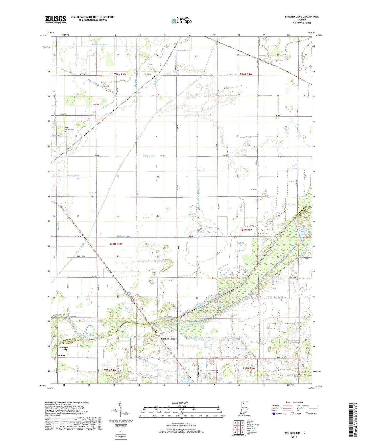
2022 topographic map quadrangle English Lake in the state of Indiana. Scale: 1:24000. Based on the newly updated USGS 7.5' US Topo map series, this map is in the following counties: LaPorte, Starke. The map contains contour data, water features, and other items you are used to seeing on USGS maps, but also has updated roads and other features. This is the next generation of topographic maps. Printed on high-quality waterproof paper with UV fade-resistant inks.
Quads adjacent to this one:
West: La Crosse
Northwest: Wanatah
North: Hanna
Northeast: Kingsford Heights
East: Knox West
Southeast: Denham
South: North Judson
Southwest: San Pierre
This map covers the same area as the classic USGS quad with code o41086c7.
Contains the following named places: Archangels Landing, Bessler Ditch, Bogus Run, Davidson Drain, English Lake, Gloor Arm, Hoffman Arm, Hundt Ditch, Kaukakee State Fish and Wildlife Area, Kline Arm, Kuehn Ditch, Lemke Ditch, Lomax, Luedtke Dairy Farm, Murphy Arm, Pine Creek, Pitner Ditch, Runnymede, Saint Martins Cemetery, Stassen Arm, Stoltz Arm, Township of Prairie, William Arm of Tuesburg Ditch, Yellow River, ZIP Code: 46348