MyTopo
La Crosse Indiana US Topo Map
Couldn't load pickup availability
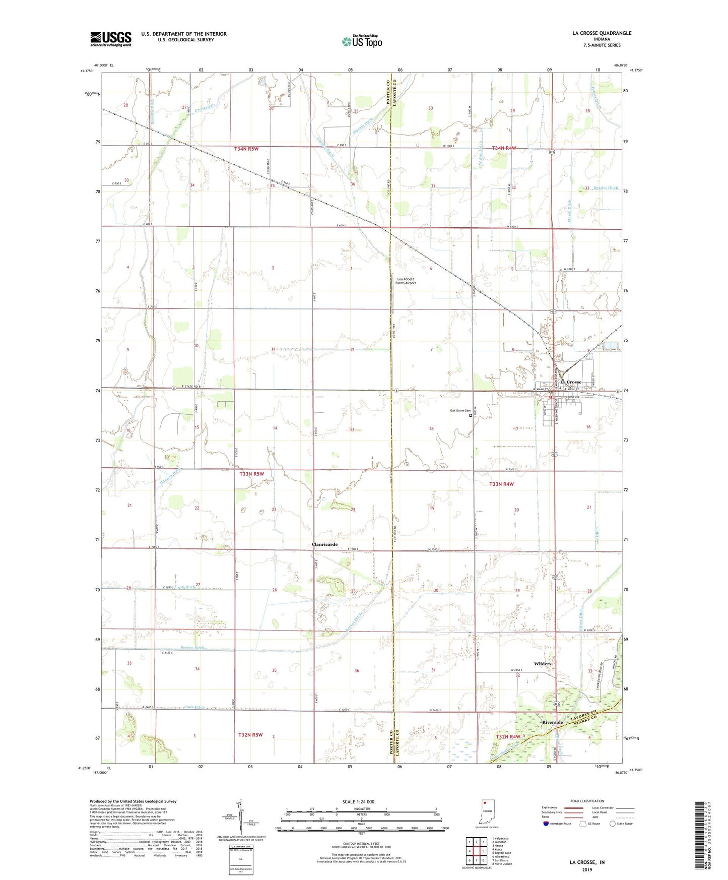
2022 topographic map quadrangle La Crosse in the state of Indiana. Scale: 1:24000. Based on the newly updated USGS 7.5' US Topo map series, this map is in the following counties: Porter, LaPorte, Starke. The map contains contour data, water features, and other items you are used to seeing on USGS maps, but also has updated roads and other features. This is the next generation of topographic maps. Printed on high-quality waterproof paper with UV fade-resistant inks.
Quads adjacent to this one:
West: Kouts
Northwest: Valparaiso
North: Wanatah
Northeast: Hanna
East: English Lake
Southeast: North Judson
South: San Pierre
Southwest: Wheatfield
This map covers the same area as the classic USGS quad with code o41086c8.
Contains the following named places: Bucher Hog Farm, Clanricarde, Cook Ditch, Crooked Creek, Eckert Ditch, Greiger Ditch, Hannon Ditch, Heimberg Ditch, Keller Arm, Koselke Ditch, La Crosse, La Crosse Elementary and High School, La Crosse Post Office, La Crosse Volunteer Fire Department, Lee Ditch, Lou Abbett Farms Airport, Lyon Ditch, Marsh Ditch, Oak Grove Cemetery, Payne Ditch, Reeves Ditch, Riverside, Slocum Ditch, Town of La Crosse, Township of Dewey, West Arm Ditch, Wilders