MyTopo
Epsom Indiana US Topo Map
Couldn't load pickup availability
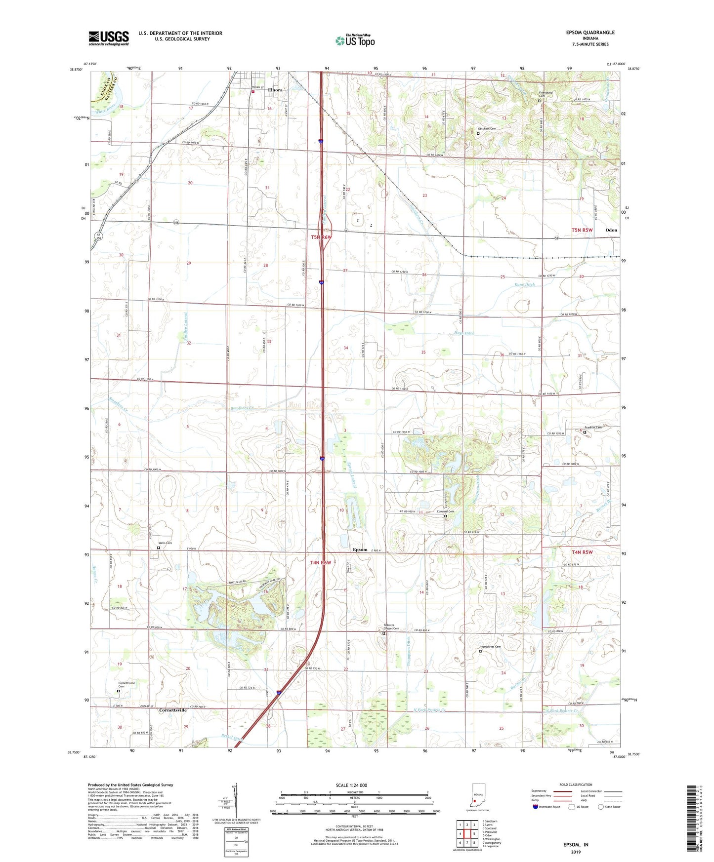
2022 topographic map quadrangle Epsom in the state of Indiana. Scale: 1:24000. Based on the newly updated USGS 7.5' US Topo map series, this map is in the following counties: Daviess, Knox. The map contains contour data, water features, and other items you are used to seeing on USGS maps, but also has updated roads and other features. This is the next generation of topographic maps. Printed on high-quality waterproof paper with UV fade-resistant inks.
Quads adjacent to this one:
West: Plainville
Northwest: Sandborn
North: Lyons
Northeast: Scotland
East: Odon
Southeast: Loogootee
South: Montgomery
Southwest: Washington
This map covers the same area as the classic USGS quad with code o38087g1.
Contains the following named places: Baile Church, Barnes Branch, Bethel Church, Bethel Ditch, Concord Cemetery, Cornettsville, Cornettsville Cemetery, Elnora - Elmore Volunteer Fire Department, Elnora Elementary School, Epsom, Epsom Lateral, Epworth Church, Findley Lateral, Franklin Cemetery, Friendship Cemetery, Hays Ditch, Humphries Cemetery, Kane Ditch, Ketchem Cemetery, North Daviess Junior-Senior High School, Prairie Creek Structure Number A-2-3, Talbotts Chapel Cemetery, Thompson Ditch, Township of Bogard, Township of Elmore, Ventress Ditch, Wells Cemetery, ZIP Codes: 47529, 47568