MyTopo
Sandborn Indiana US Topo Map
Couldn't load pickup availability
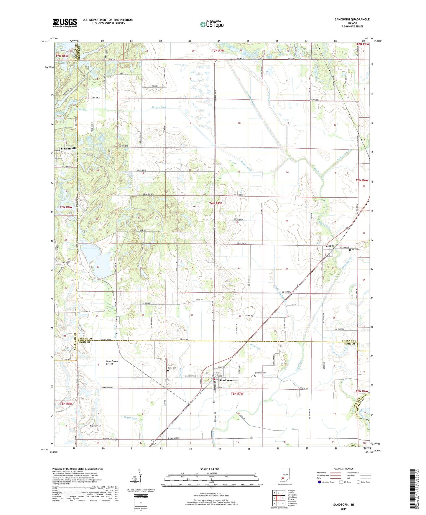
2022 topographic map quadrangle Sandborn in the state of Indiana. Scale: 1:24000. Based on the newly updated USGS 7.5' US Topo map series, this map is in the following counties: Greene, Knox, Sullivan, Daviess. The map contains contour data, water features, and other items you are used to seeing on USGS maps, but also has updated roads and other features. This is the next generation of topographic maps. Printed on high-quality waterproof paper with UV fade-resistant inks.
Quads adjacent to this one:
West: Bucktown
Northwest: Dugger
North: Linton
Northeast: Switz City
East: Lyons
Southeast: Epsom
South: Plainville
Southwest: Bicknell
This map covers the same area as the classic USGS quad with code o38087h2.
Contains the following named places: Armuth Ditch, Begeman Cemetery, Bethel Church, Black Creek Ditch, Brewer Ditch, Burris Chapel, Calico Slash Ditch, Cane Green Bottom, Delay Cemetery, Goose Pond, Greene-Sullivan State Forest, Hamilton Ditch, Hill Ditch, Marco, Marco Cemetery, McGinnis Levee, Neal Levee, Pleasant Grove Church, Sandborn, Sandborn Cemetery, Sandborn Post Office, Sandborn Volunteer Fire Department, Singer Ditch, Singer Ditch Dam, Spencer Creek, Stafford Church, Town of Sandborn, Township of Stafford, ZIP Code: 47578