MyTopo
Plainville Indiana US Topo Map
Couldn't load pickup availability
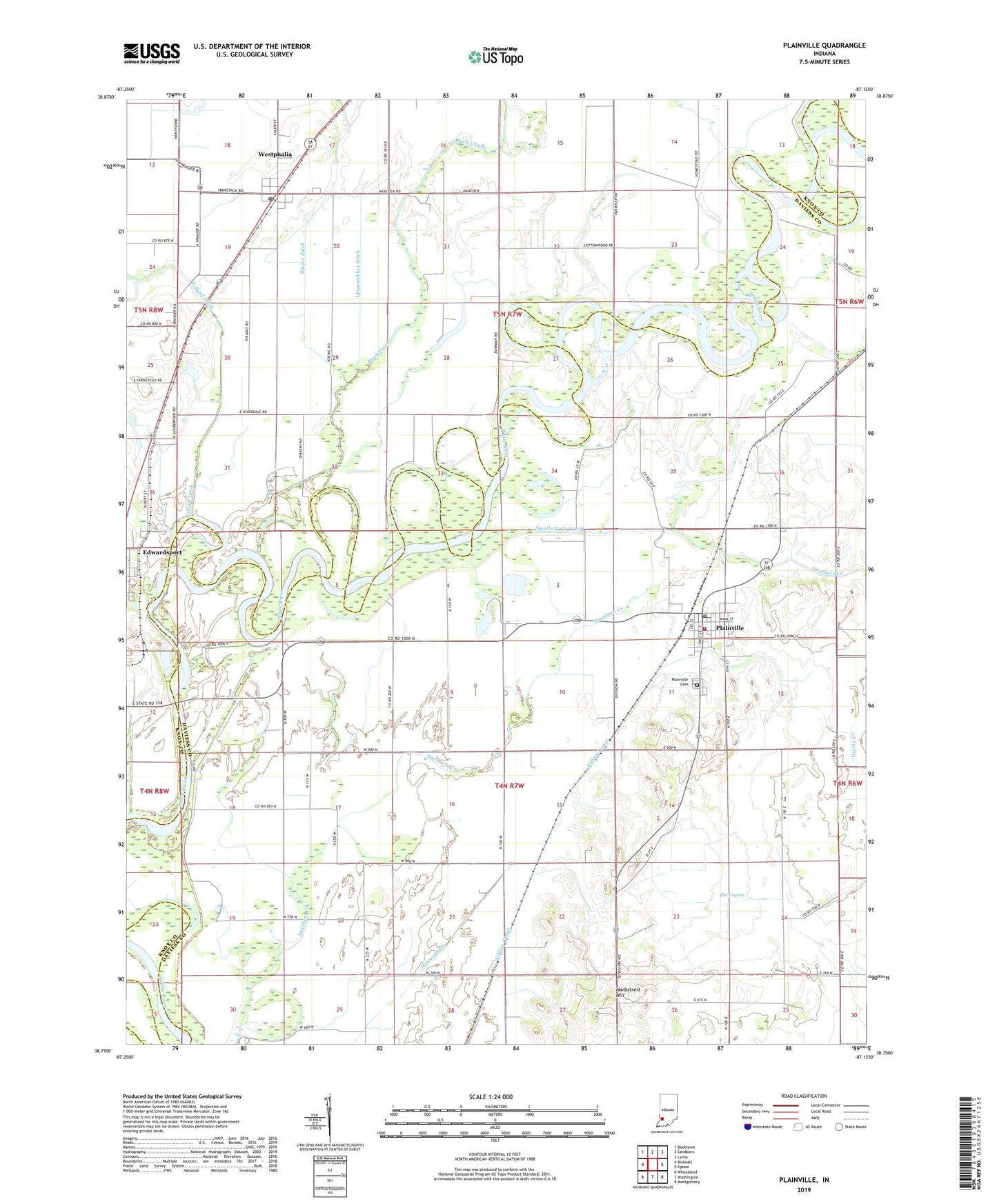
2022 topographic map quadrangle Plainville in the state of Indiana. Scale: 1:24000. Based on the newly updated USGS 7.5' US Topo map series, this map is in the following counties: Daviess, Knox. The map contains contour data, water features, and other items you are used to seeing on USGS maps, but also has updated roads and other features. This is the next generation of topographic maps. Printed on high-quality waterproof paper with UV fade-resistant inks.
Quads adjacent to this one:
West: Bicknell
Northwest: Bucktown
North: Sandborn
Northeast: Lyons
East: Epsom
Southeast: Montgomery
South: Washington
Southwest: Wheatland
This map covers the same area as the classic USGS quad with code o38087g2.
Contains the following named places: Bennington Levee, Black Armuth Ditch, Black Creek, Hanna Creek, Harbstreit Hill, Linnewebber Ditch, N'Meier Airport, Plainville, Plainville Cemetery, Plainville Post Office, Plainville Volunteer Fire Department, Salem Church, Smothers Creek Cutoff, The Lagoon, Town of Plainville, Township of Steele, Township of Vigo, Wagner Station, Westphalia, Westphalia Census Designated Place, Westphalia Post Office, Zion Church, ZIP Code: 47596