MyTopo
Washington Indiana US Topo Map
Couldn't load pickup availability
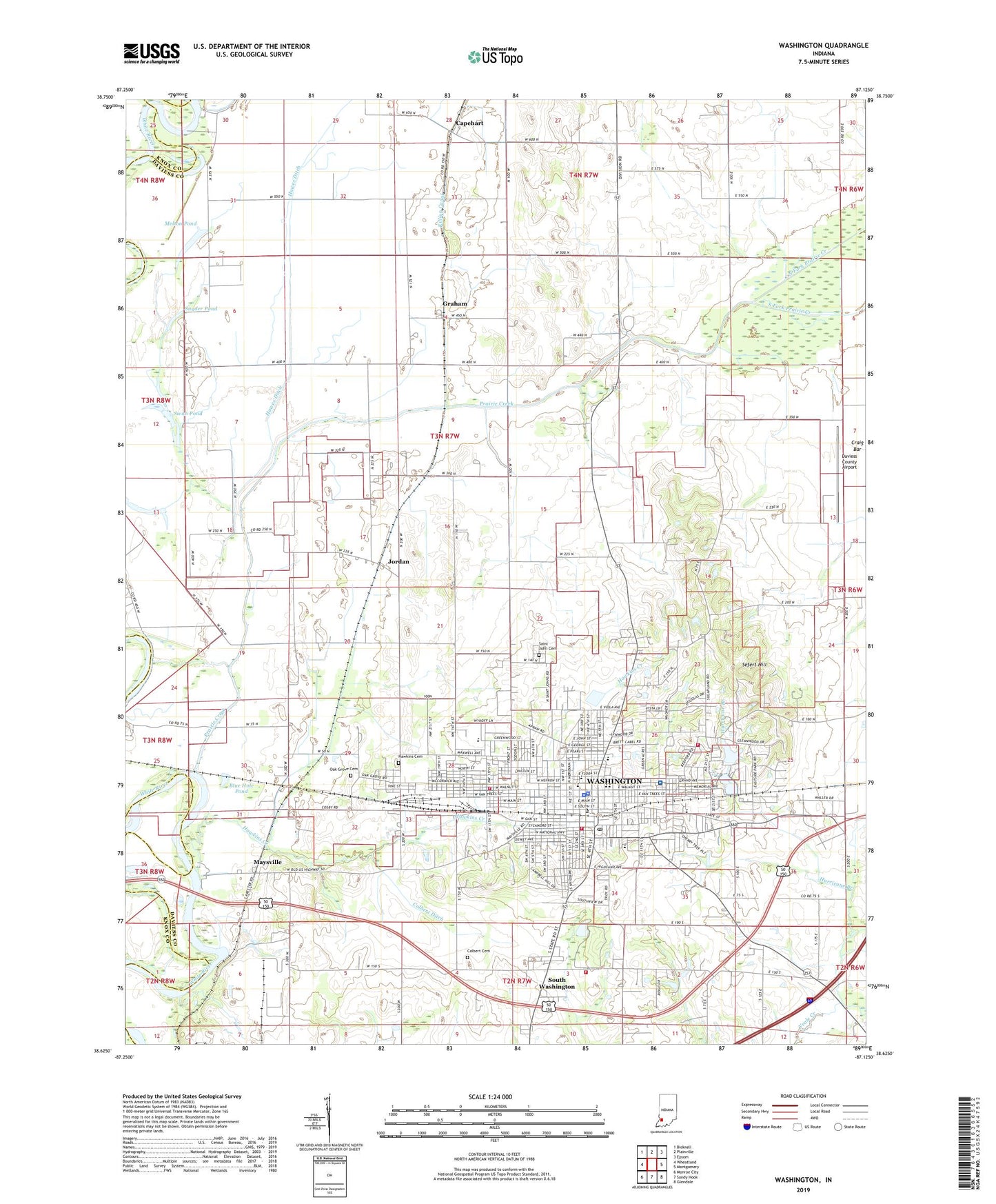
2022 topographic map quadrangle Washington in the state of Indiana. Scale: 1:24000. Based on the newly updated USGS 7.5' US Topo map series, this map is in the following counties: Daviess, Knox. The map contains contour data, water features, and other items you are used to seeing on USGS maps, but also has updated roads and other features. This is the next generation of topographic maps. Printed on high-quality waterproof paper with UV fade-resistant inks.
Quads adjacent to this one:
West: Wheatland
Northwest: Bicknell
North: Plainville
Northeast: Epsom
East: Montgomery
Southeast: Glendale
South: Sandy Hook
Southwest: Monroe City
This map covers the same area as the classic USGS quad with code o38087f2.
Contains the following named places: Blue Hole Pond, Capehart, City of Washington, Colbert Cemetery, Colbert Ditch, Craig Bar, Daviess Community Hospital, Daviess County Airport, Daviess County Sheriff's Office, East Side Park, Graham, Hawes Ditch, Hawkins Cemetery, Hawkins Creek, Hurricane Branch, Jefferson School, Jordan, Killion Canal, Lettsville, Longfellow School, Maysville, Melton Pond, North Elementary School, North Fork Prairie Creek, Oak Grove Cemetery, Prairie Creek, Saint John Cemetery, Sefert Hill, Smothers Creek, Snyder Pond, South Fork Prairie Creek, South Side School, South Washington, Southwest Medical Services, Sugarland Church, Sugarland School, Swan Pond, Thousand Acre Woods, Township of Washington, Veale Creek Church, WAMN-AM (Washington), Washington, Washington Fire Department Station 1, Washington Fire Department Station 2, Washington High School, Washington Junior High School, Washington Police Department, Washington Post Office, Washington Township Volunteer Fire Department Station 1, Washington Township Volunteer Fire Department Station 2, Washington Waterworks, West End School, WFML-FM (Washington), ZIP Code: 47501