MyTopo
Gifford Indiana US Topo Map
Couldn't load pickup availability
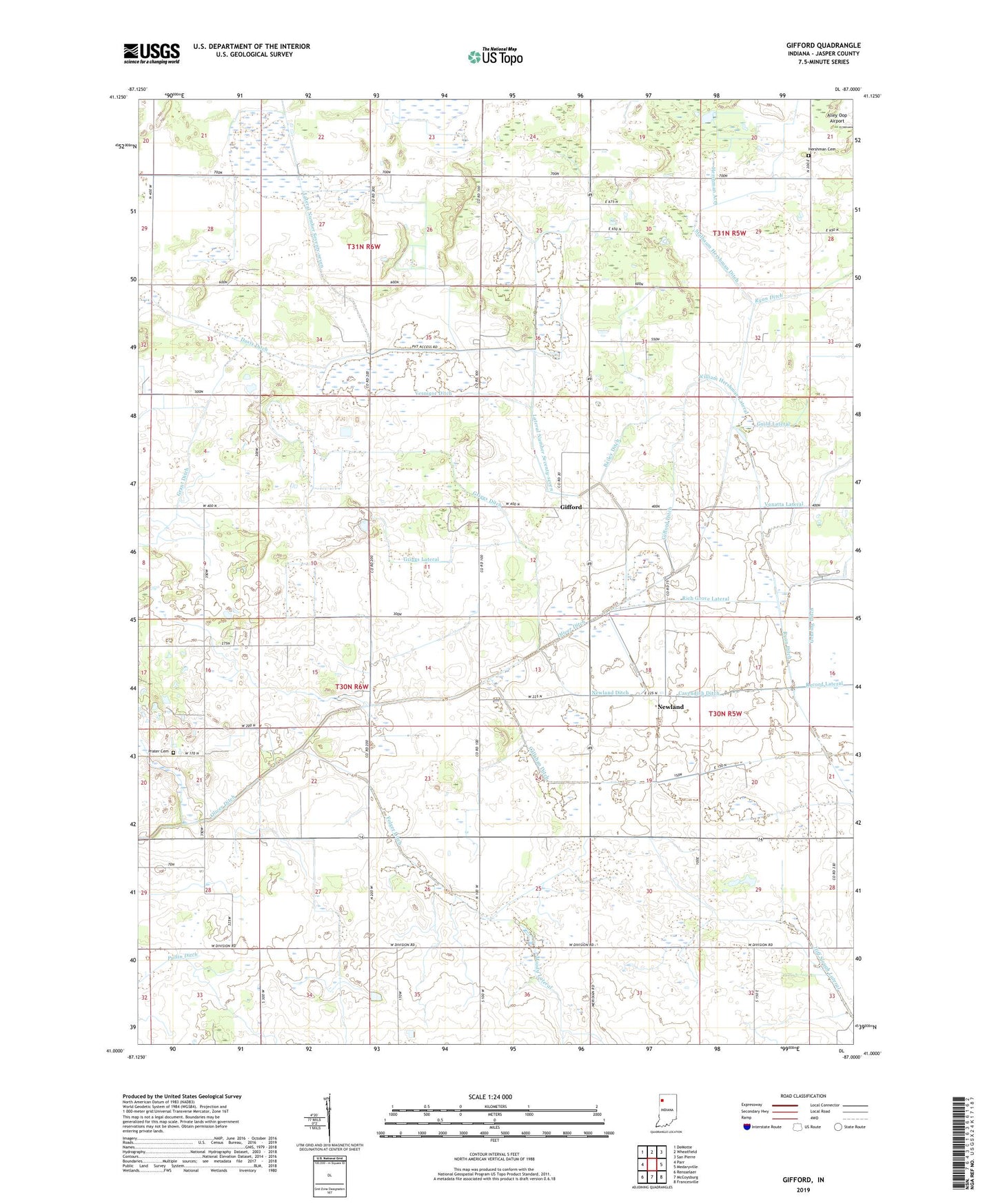
2022 topographic map quadrangle Gifford in the state of Indiana. Scale: 1:24000. Based on the newly updated USGS 7.5' US Topo map series, this map is in the following counties: Jasper. The map contains contour data, water features, and other items you are used to seeing on USGS maps, but also has updated roads and other features. This is the next generation of topographic maps. Printed on high-quality waterproof paper with UV fade-resistant inks.
Quads adjacent to this one:
West: Parr
Northwest: DeMotte
North: Wheatfield
Northeast: San Pierre
East: Medaryville
Southeast: Francesville
South: McCoysburg
Southwest: Rensselaer
This map covers the same area as the classic USGS quad with code o41087a1.
Contains the following named places: Alley Oop Airport, Bailey Ditch, Callahan Ditch, Cavendish Ditch, Folger Ditch, Gehring Ditch, Gifford, Gifford Ditch, Grant Ditch, Griggs Ditch, Griggs Lateral, Guild Lateral, Hershman Arm, Hershman Cemetery, Jasper County, Lateral Number Seventy-seven, Laura, Lewiston, Moody Lateral, Newland, Newland Ditch, Oak Grove Church, Oliver Ditch, Prater Cemetery, Rich Grove Lateral, Ryan Ditch, Stalbaum Hershman Ditch, Township of Barkley, Vernigor Ditch, William Hershman Lateral, Wynkoop Ditch