MyTopo
McCoysburg Indiana US Topo Map
Couldn't load pickup availability
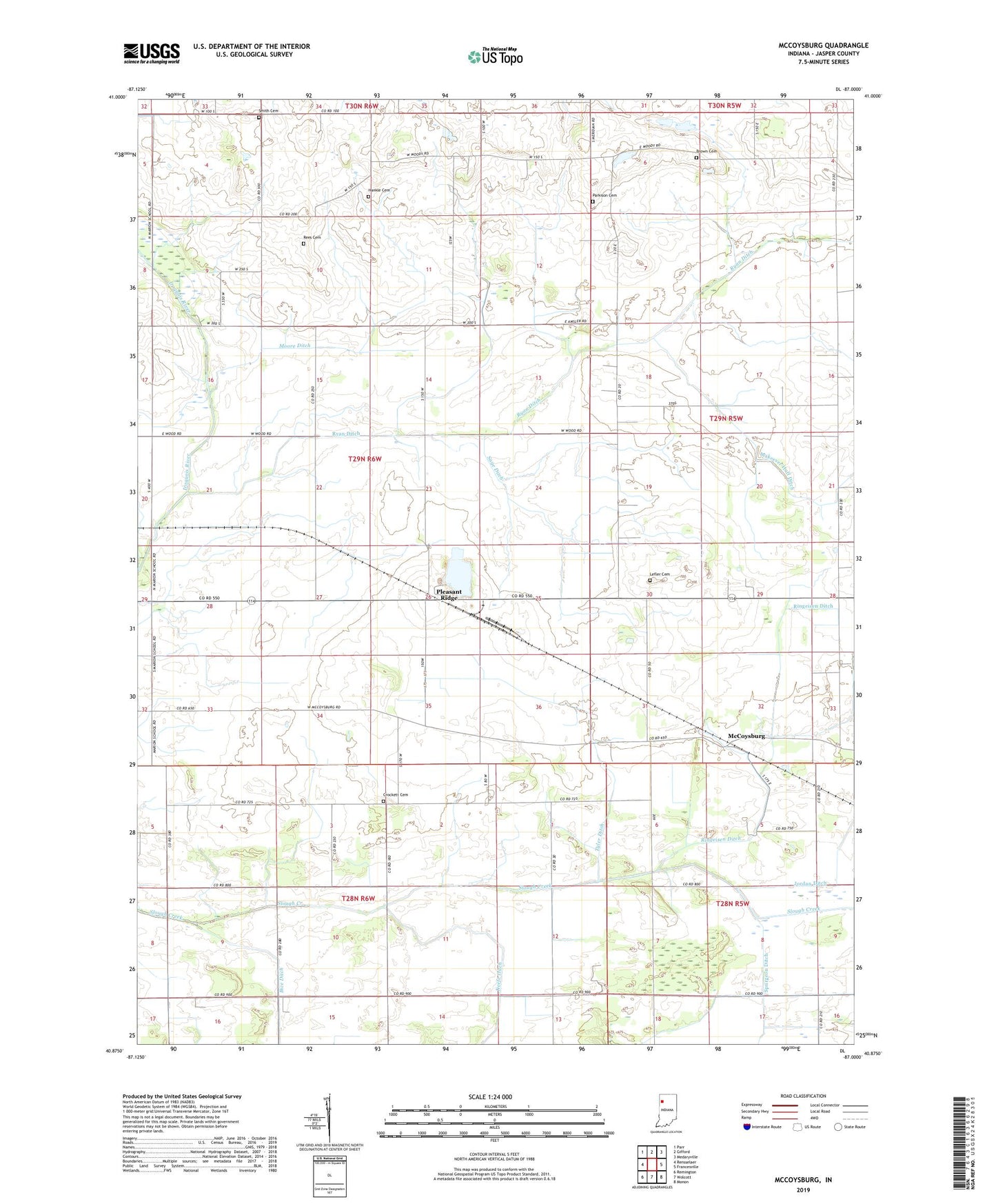
2022 topographic map quadrangle McCoysburg in the state of Indiana. Scale: 1:24000. Based on the newly updated USGS 7.5' US Topo map series, this map is in the following counties: Jasper. The map contains contour data, water features, and other items you are used to seeing on USGS maps, but also has updated roads and other features. This is the next generation of topographic maps. Printed on high-quality waterproof paper with UV fade-resistant inks.
Quads adjacent to this one:
West: Rensselaer
Northwest: Parr
North: Gifford
Northeast: Medaryville
East: Francesville
Southeast: Monon
South: Wolcott
Southwest: Remington
This map covers the same area as the classic USGS quad with code o40087h1.
Contains the following named places: Barkley Church, Brown Cemetery, Crockett Cemetery, Gilmore Airport, Hankle Cemetery, Lefler Cemetery, Makeever Huff Ditch, McCoysburg, Moody, Moore Ditch, Parkison Cemetery, Pleasant Ridge, Randle Lateral, Rees Cemetery, Ringeisen Ditch, Sage Ditch, Smith Cemetery, Spurgeon Ditch, Tyler Ditch, ZIP Code: 47978