MyTopo
Rensselaer Indiana US Topo Map
Couldn't load pickup availability
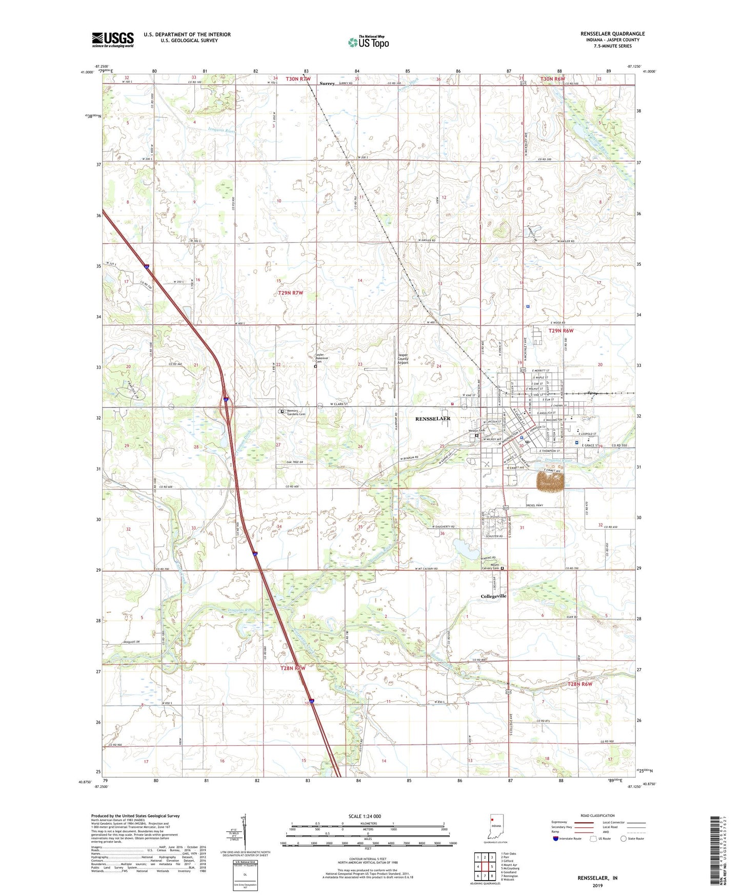
2022 topographic map quadrangle Rensselaer in the state of Indiana. Scale: 1:24000. Based on the newly updated USGS 7.5' US Topo map series, this map is in the following counties: Jasper. The map contains contour data, water features, and other items you are used to seeing on USGS maps, but also has updated roads and other features. This is the next generation of topographic maps. Printed on high-quality waterproof paper with UV fade-resistant inks.
Quads adjacent to this one:
West: Mount Ayr
Northwest: Fair Oaks
North: Parr
Northeast: Gifford
East: McCoysburg
Southeast: Wolcott
South: Remington
Southwest: Goodland
This map covers the same area as the classic USGS quad with code o40087h2.
Contains the following named places: Babcock Quarry, Bethany Church, Borntraeger Airstrip, Brook Side Park, Carpenter Creek, City of Rensselaer, Collegeville, Collegeville Census Designated Place, Curtis Creek, Franciscan Health Rensselaer General Hospital, Jasper County Airport, Jasper County Sheriff's Office, Memory Gardens Cemetery, Monnett Elementary School, Mount Calvary Cemetery, North Marion, North Newton School, Prompt Ambulance Service, Prouty Ditch, Rensselaer, Rensselaer Central High School, Rensselaer Police Department, Rensselaer Post Office, Rensselaer Volunteer Fire Department, Saint Augustine School, Saint Josephs College, Saint Lukes Church, Saint Peters Church, Sayler Makeever Cemetery, Slough Creek, South Marion, Surrey, Township of Marion, Township of Newton, Van Rensselaer Elementary School, Weston Cemetery, WJCK-FM (Rensselaer), WPUM-FM (Rensselaer), WRIN-AM (Rensselaer), Yeoman Ditch