MyTopo
Parr Indiana US Topo Map
Couldn't load pickup availability
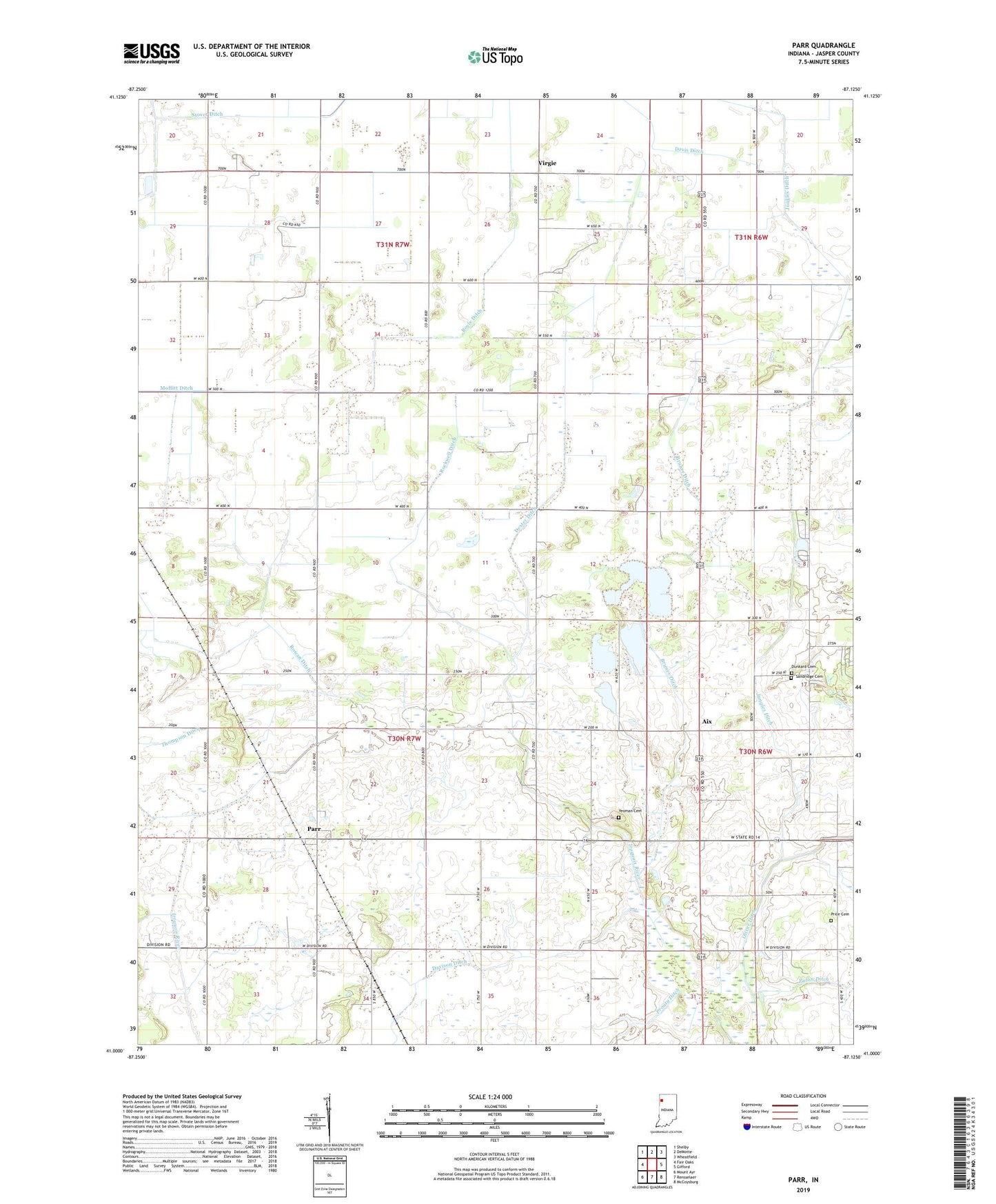
2022 topographic map quadrangle Parr in the state of Indiana. Scale: 1:24000. Based on the newly updated USGS 7.5' US Topo map series, this map is in the following counties: Jasper. The map contains contour data, water features, and other items you are used to seeing on USGS maps, but also has updated roads and other features. This is the next generation of topographic maps. Printed on high-quality waterproof paper with UV fade-resistant inks.
Quads adjacent to this one:
West: Fair Oaks
Northwest: Shelby
North: DeMotte
Northeast: Wheatfield
East: Gifford
Southeast: McCoysburg
South: Rensselaer
Southwest: Mount Ayr
This map covers the same area as the classic USGS quad with code o41087a2.
Contains the following named places: Aix, Boyle Ditch, Bruner Ditch, Brushwood Church, Davis Ditch, Davison Ditch, Dexter Ditch, Dunkard Cemetery, Haa-guar Shopping Center, Jungles Ditch, Moffitt, Parr, Price Cemetery, Pullin Ditch, Rockwell Ditch, Rosebud, Rowan Ditch, Saint Johns Church, Sandridge Cemetery, State Boulevard Plaza, Stover Ditch, Township of Union, Virgie, Yeoman Cemetery