MyTopo
Hebron Indiana US Topo Map
Couldn't load pickup availability
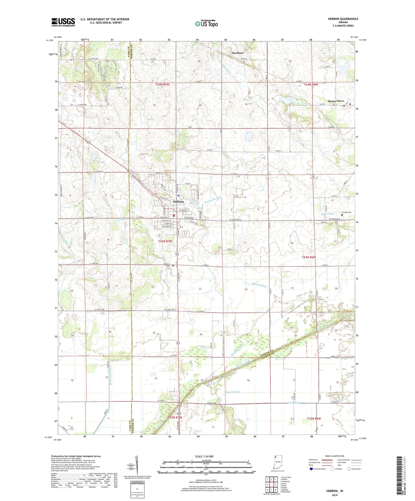
2022 topographic map quadrangle Hebron in the state of Indiana. Scale: 1:24000. Based on the newly updated USGS 7.5' US Topo map series, this map is in the following counties: Porter, Lake, Jasper. The map contains contour data, water features, and other items you are used to seeing on USGS maps, but also has updated roads and other features. This is the next generation of topographic maps. Printed on high-quality waterproof paper with UV fade-resistant inks.
Quads adjacent to this one:
West: Leroy
Northwest: Crown Point
North: Palmer
Northeast: Valparaiso
East: Kouts
Southeast: Wheatfield
South: DeMotte
Southwest: Shelby
This map covers the same area as the classic USGS quad with code o41087c2.
Contains the following named places: Boone Grove, Boone Grove Elementary School, Boone Grove Fire Department, Boone Grove Junior-Senior High School, Boone Grove Post Office, Brown Levee Ditch, Cobb Creek, Cook Ditch, Cornell Cemetery, Cornell Ditch, Dog Lake, Emmanuel Baptist Church, Fisher Pond, Flying J Airport, Gas Lite Mobile Home Park, Hebron, Hebron Cemetery, Hebron Elementary School, Hebron Junior-Senior High School, Hebron Police Department, Hebron Post Office, Hebron Volunteer Fire Department, Henderson Ditch, Hurlburt, Keller Ditch, Kithcart Ditch, Louis Alyea Memorial Park, Porter Emergency Medical Services Station 3, Stony Run, Stony Run Ditch, Town of Hebron, Township of Boone, ZIP Code: 46341