MyTopo
Leroy Indiana US Topo Map
Couldn't load pickup availability
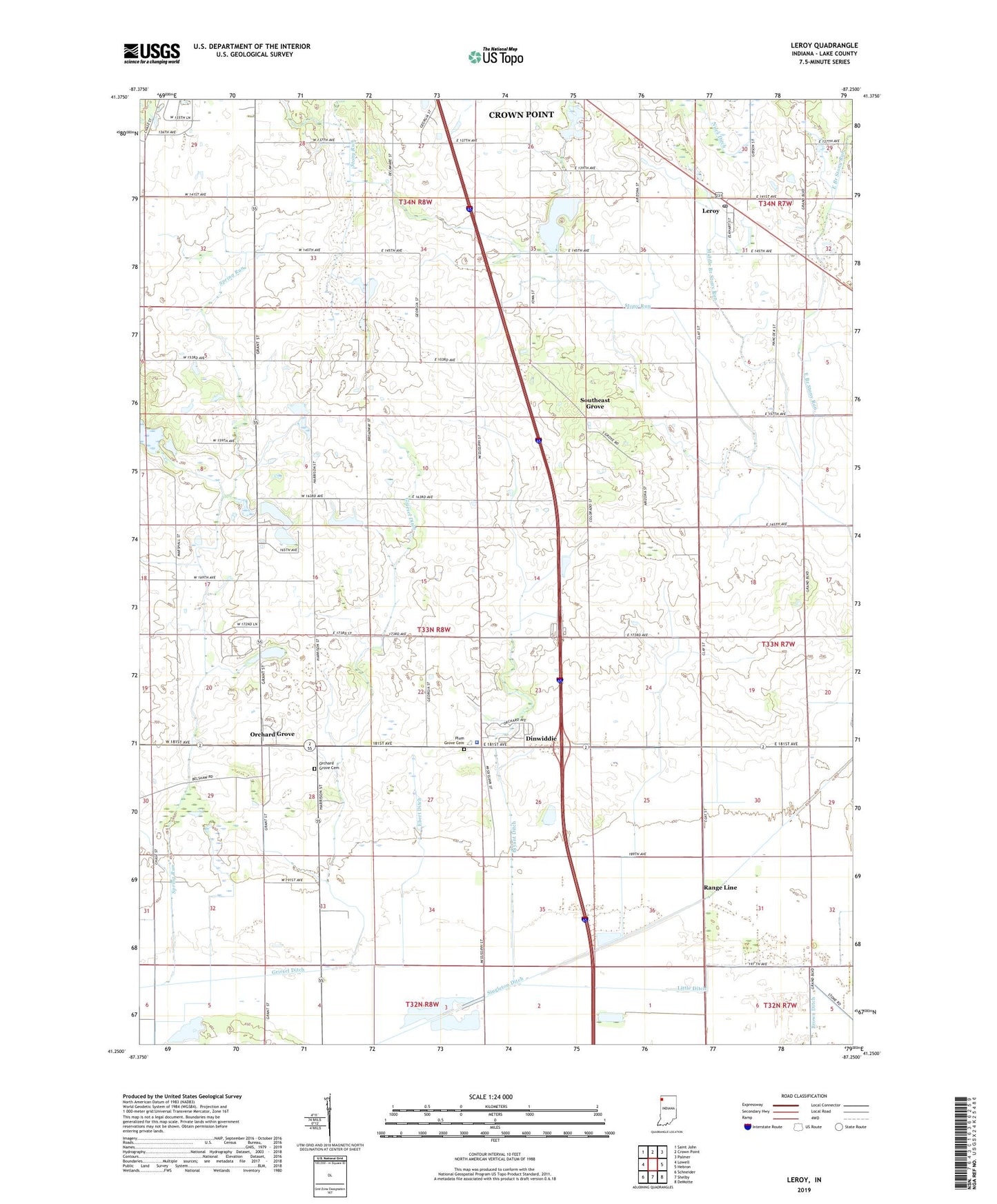
2022 topographic map quadrangle Leroy in the state of Indiana. Scale: 1:24000. Based on the newly updated USGS 7.5' US Topo map series, this map is in the following counties: Lake. The map contains contour data, water features, and other items you are used to seeing on USGS maps, but also has updated roads and other features. This is the next generation of topographic maps. Printed on high-quality waterproof paper with UV fade-resistant inks.
Quads adjacent to this one:
West: Lowell
Northwest: Saint John
North: Crown Point
Northeast: Palmer
East: Hebron
Southeast: DeMotte
South: Shelby
Southwest: Schneider
This map covers the same area as the classic USGS quad with code o41087c3.
Contains the following named places: Apple Valley Estates, Bryant Ditch, Center Elementary School, Dinwiddie, Eagle Creek, East Branch Stony Run, Ebert Ditch, Griesel Ditch, Indiana State Police Department District 13, Leroy, Leroy Community Park, Leroy Post Office, Little Ditch, Middle Branch Stony Run, Orchard Grove, Orchard Grove Cemetery, Plum Grove Cemetery, Range Line, Southeast Grove, Spring Run, Township of Eagle Creek, WWJY-FM (Crown Point)