MyTopo
Holton Indiana US Topo Map
Couldn't load pickup availability
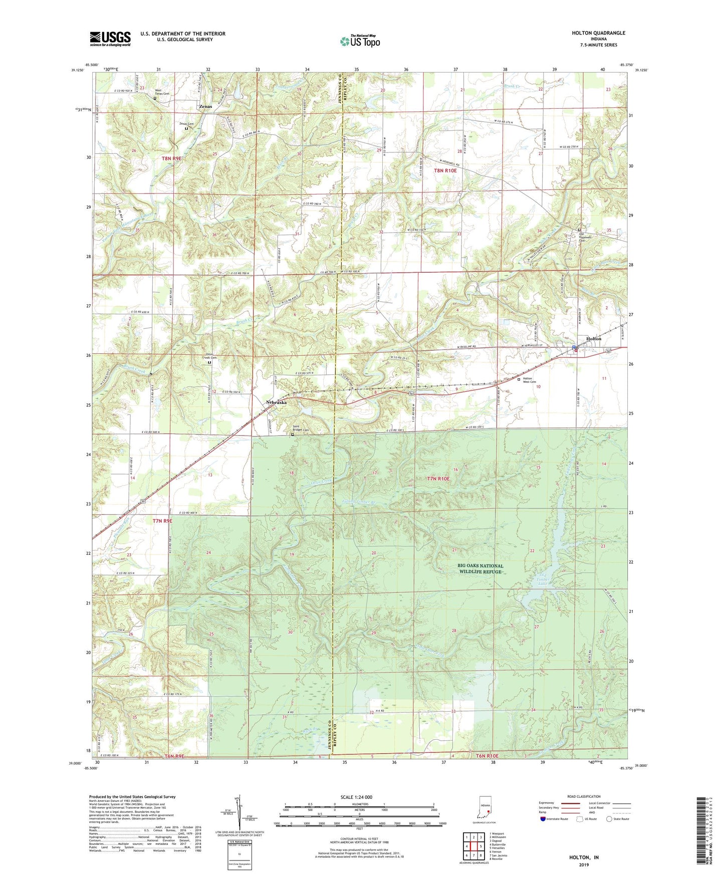
2022 topographic map quadrangle Holton in the state of Indiana. Scale: 1:24000. Based on the newly updated USGS 7.5' US Topo map series, this map is in the following counties: Ripley, Jennings. The map contains contour data, water features, and other items you are used to seeing on USGS maps, but also has updated roads and other features. This is the next generation of topographic maps. Printed on high-quality waterproof paper with UV fade-resistant inks.
Quads adjacent to this one:
West: Butlerville
Northwest: Westport
North: Millhousen
Northeast: Osgood
East: Versailles
Southeast: Rexville
South: San Jacinto
Southwest: Vernon
This map covers the same area as the classic USGS quad with code o39085a4.
Contains the following named places: Bear Branch, Brush Creek State Fish and Wildlife Area, Falling Timber Branch, Finch Branch, Holton, Holton Elementary School, Holton Police Department, Holton Post Office, Holton West Cemetery, Hopewell Church, Jackson, Leatherwood Creek, Leatherwood Lake Dam, Little Otter Creek, Little Otter Fork, Nebraska, Old Hopewell Cemetery, Old Timber Lake, Old Timber Lake Dam, Old Timbers Lodge, Otter Creek Cemetery, Otter Creek Township Volunteer Fire Department, Saint Bridget Cemetery, Sugar Creek, Town of Holton, Township of Columbia, Township of Otter Creek, West Zenas Cemetery, Zenas, Zenas Cemetery, Zenas Elementary School, ZIP Codes: 47023, 47223