MyTopo
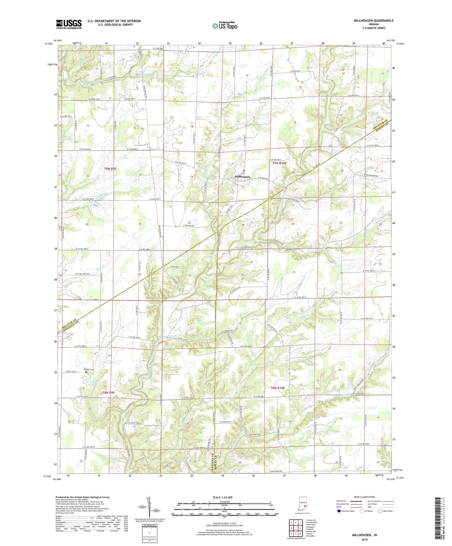
Millhousen Indiana US Topo Map
Couldn't load pickup availability
2022 topographic map quadrangle Millhousen in the state of Indiana. Scale: 1:24000. Based on the newly updated USGS 7.5' US Topo map series, this map is in the following counties: Ripley, Decatur, Jennings. The map contains contour data, water features, and other items you are used to seeing on USGS maps, but also has updated roads and other features. This is the next generation of topographic maps. Printed on high-quality waterproof paper with UV fade-resistant inks.
Quads adjacent to this one:
West: Westport
Northwest: Forest Hill
North: Greensburg
Northeast: New Point
East: Osgood
Southeast: Versailles
South: Holton
Southwest: Butlerville
This map covers the same area as the classic USGS quad with code o39085b4.
Contains the following named places: Cornell Cemetery, Degenhart School, Fall Branch, Flatrock Creek, Honey Creek, Jordan Creek, Lock Spring, Lock Spring Post Office, Millhousen, Millhousen - Marion Township Volunteer Fire Department, Saint Dennis Church, Square Run, Town of Millhousen, Township of Marion, Union Flatrock Church, Wolf Creek