MyTopo
Versailles Indiana US Topo Map
Couldn't load pickup availability
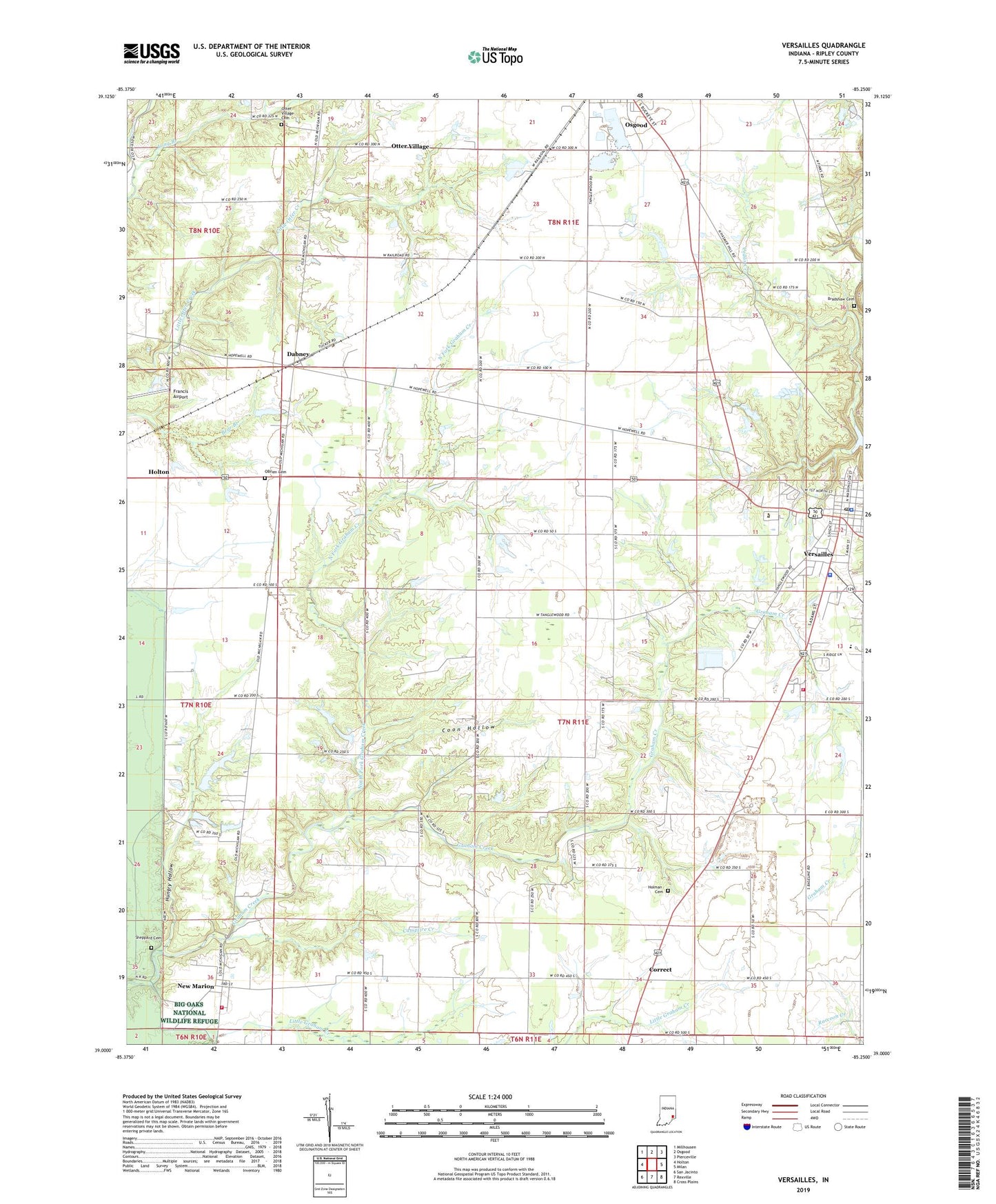
2022 topographic map quadrangle Versailles in the state of Indiana. Scale: 1:24000. Based on the newly updated USGS 7.5' US Topo map series, this map is in the following counties: Ripley. The map contains contour data, water features, and other items you are used to seeing on USGS maps, but also has updated roads and other features. This is the next generation of topographic maps. Printed on high-quality waterproof paper with UV fade-resistant inks.
Quads adjacent to this one:
West: Holton
Northwest: Millhousen
North: Osgood
Northeast: Pierceville
East: Milan
Southeast: Cross Plains
South: Rexville
Southwest: San Jacinto
This map covers the same area as the classic USGS quad with code o39085a3.
Contains the following named places: Allen Crossing, Bradshaw Cemetery, Campfire Creek, Cedar Creek, Cedar Creek Church, Coon Hollow, Correct, Dabney, Francis Airport, Holman Cemetery, Hungry Hollow, Indiana State Police District 42, Long Branch, New Marion, New Marion Volunteer Fire Department, North Fork Graham Creek, OBrien Cemetery, Otter Village, Otter Village Cemetery, Ripley County, Sheppard Cemetery, Southern Ripley County Emergency Life Squad Rescue 69, Tanglewood Church, Tanglewood Post Office, Town of Versailles, Versailles, Versailles Elementary School, Versailles Fire Department, Versailles Police Department, Versailles Post Office, ZIP Code: 47042