MyTopo
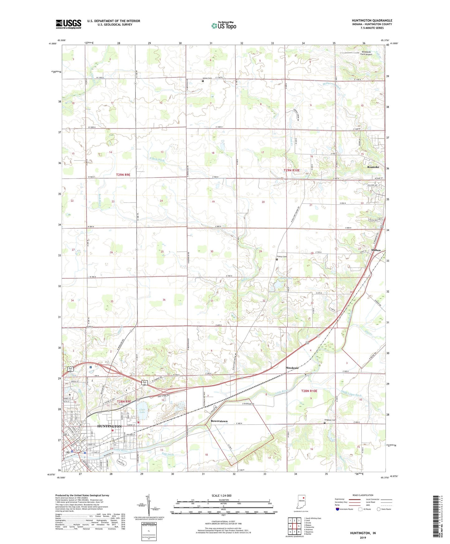
Huntington Indiana US Topo Map
Couldn't load pickup availability
2022 topographic map quadrangle Huntington in the state of Indiana. Scale: 1:24000. Based on the newly updated USGS 7.5' US Topo map series, this map is in the following counties: Huntington. The map contains contour data, water features, and other items you are used to seeing on USGS maps, but also has updated roads and other features. This is the next generation of topographic maps. Printed on high-quality waterproof paper with UV fade-resistant inks.
Quads adjacent to this one:
West: Bippus
Northwest: South Whitley East
North: Laud
Northeast: Arcola
East: Zanesville
Southeast: Markle
South: Majenica
Southwest: Andrews
This map covers the same area as the classic USGS quad with code o40085h4.
Contains the following named places: Beck Ditch, Big Blue Lake, Bowerstown, Bull Creek, Clair Lake, Clear Creek Church, College Park Church, Crestview Junior High School, Fahl Ditch, Feighner Cemetery, Flat Creek, Flint Creek, France Cemetery, Horace Mann Elementary School, Huntington, Huntington City Fire Department, Huntington City Fire Department Condit Street Station 1, Huntington College, Huntington College Lake, Huntington College Lake Dam, Huntington County Rescue Squad, Huntington County Sheriff's Office, Huntington Drive-In, Huntington Police Department, Huntington Post Office, Huntington Quarry, Huntington Township Fire Department, Kilsoquah Farm Airport, Laurie Park, Lincoln Elementary School, Mahon, Mardenis, Mount Etna Church, Mud Creek, North Beck Ditch, Parkview Huntington Hospital, Pleasant Chapel, Rabbit Run, Riley School, Roanoke Elementary School, Saint Mary School, Smith Limer Ditch, The Wolf Den Airport, Timber Lake, Timber Lake Dam, Town of Roanoke, Township of Jackson, Union Cemetery, Union Church, WHLT-AM (Huntington), WHUZ-FM (Huntington), Zion Church, ZIP Code: 46750