MyTopo
Bippus Indiana US Topo Map
Couldn't load pickup availability
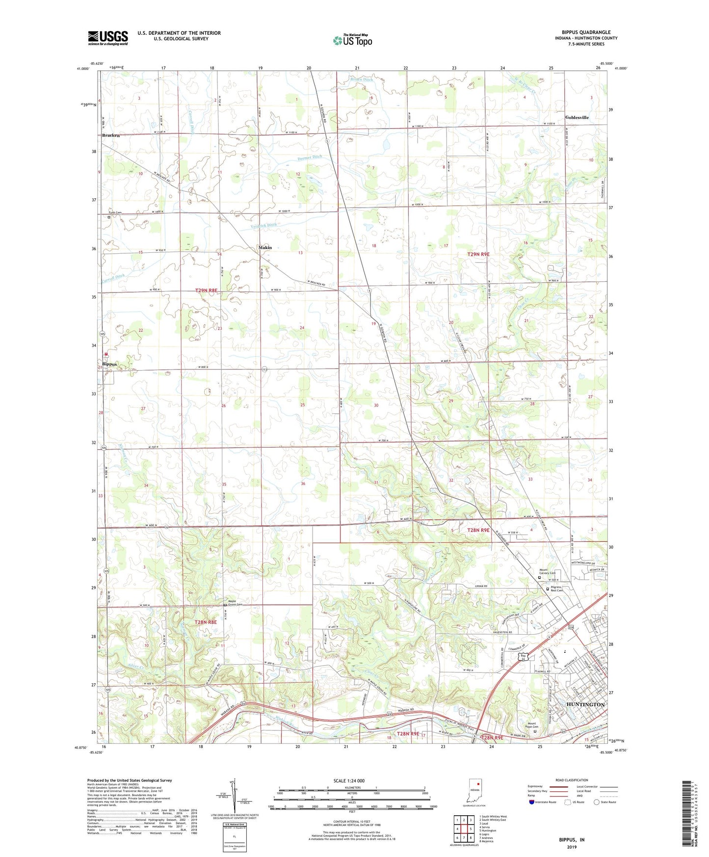
2022 topographic map quadrangle Bippus in the state of Indiana. Scale: 1:24000. Based on the newly updated USGS 7.5' US Topo map series, this map is in the following counties: Huntington. The map contains contour data, water features, and other items you are used to seeing on USGS maps, but also has updated roads and other features. This is the next generation of topographic maps. Printed on high-quality waterproof paper with UV fade-resistant inks.
Quads adjacent to this one:
West: Servia
Northwest: South Whitley West
North: South Whitley East
Northeast: Laud
East: Huntington
Southeast: Majenica
South: Andrews
Southwest: Lagro
This map covers the same area as the classic USGS quad with code o40085h5.
Contains the following named places: Beck Private Airport, Beech Grove Church, Bethesda Church, Bippus, Bippus West Fire Department, Bracken, Brown Ditch, Carroll Ditch, City of Huntington, Clear Creek, Clear Creek Church, Deemer Ditch, Funk Cemetery, Goblesville, Huntington North High School, Kriegbaum Field, Little River, Makin, Maple Grove Cemetery, Memorial Park, Mount Calvary Cemetery, Mount Hope Cemetery, Myers Ditch, Nieman Creek, Northwest Elementary School, Norwood Health and Rehabilitation Center, Pilgrims Rest Cemetery, Saint Felix Friary, Saint Peter Lutheran School, Saint Peters Church, Silver Creek, The Village School, Township of Clear Creek, Township of Warren, Verdrick Ditch, Victory Training Institute, West Branch Clear Creek, WVSH-FM (Huntington)