MyTopo
South Whitley East Indiana US Topo Map
Couldn't load pickup availability
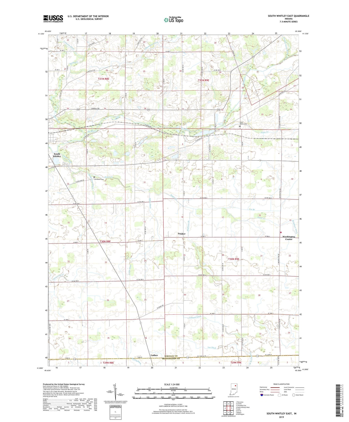
2022 topographic map quadrangle South Whitley East in the state of Indiana. Scale: 1:24000. Based on the newly updated USGS 7.5' US Topo map series, this map is in the following counties: Whitley, Huntington. The map contains contour data, water features, and other items you are used to seeing on USGS maps, but also has updated roads and other features. This is the next generation of topographic maps. Printed on high-quality waterproof paper with UV fade-resistant inks.
Quads adjacent to this one:
West: South Whitley West
Northwest: Pierceton
North: Lorane
Northeast: Columbia City
East: Laud
Southeast: Huntington
South: Bippus
Southwest: Servia
This map covers the same area as the classic USGS quad with code o41085a5.
Contains the following named places: Centenary Church, Clear Creek, Cleveland Cemetery, County Farm Ditch, Cox Branch, Eberhard Church, Fairview Church, Gable Ditch, Huffman Branch, Lee Ditch, Lehman Ditch, Luther, Saint Johns Church, Saint Peters Cemetery, Schoenauer Ditch, South Whitley Pit, Spring Creek, Stony Creek, Sugar Creek, Sugar Creek Church, Township of Washington, Tunker, Washington Center, Washington Township School, Washington Township Volunteer Fire Department Columbia City, Williamson Ditch, ZIP Code: 46787