MyTopo
Idaville Indiana US Topo Map
Couldn't load pickup availability
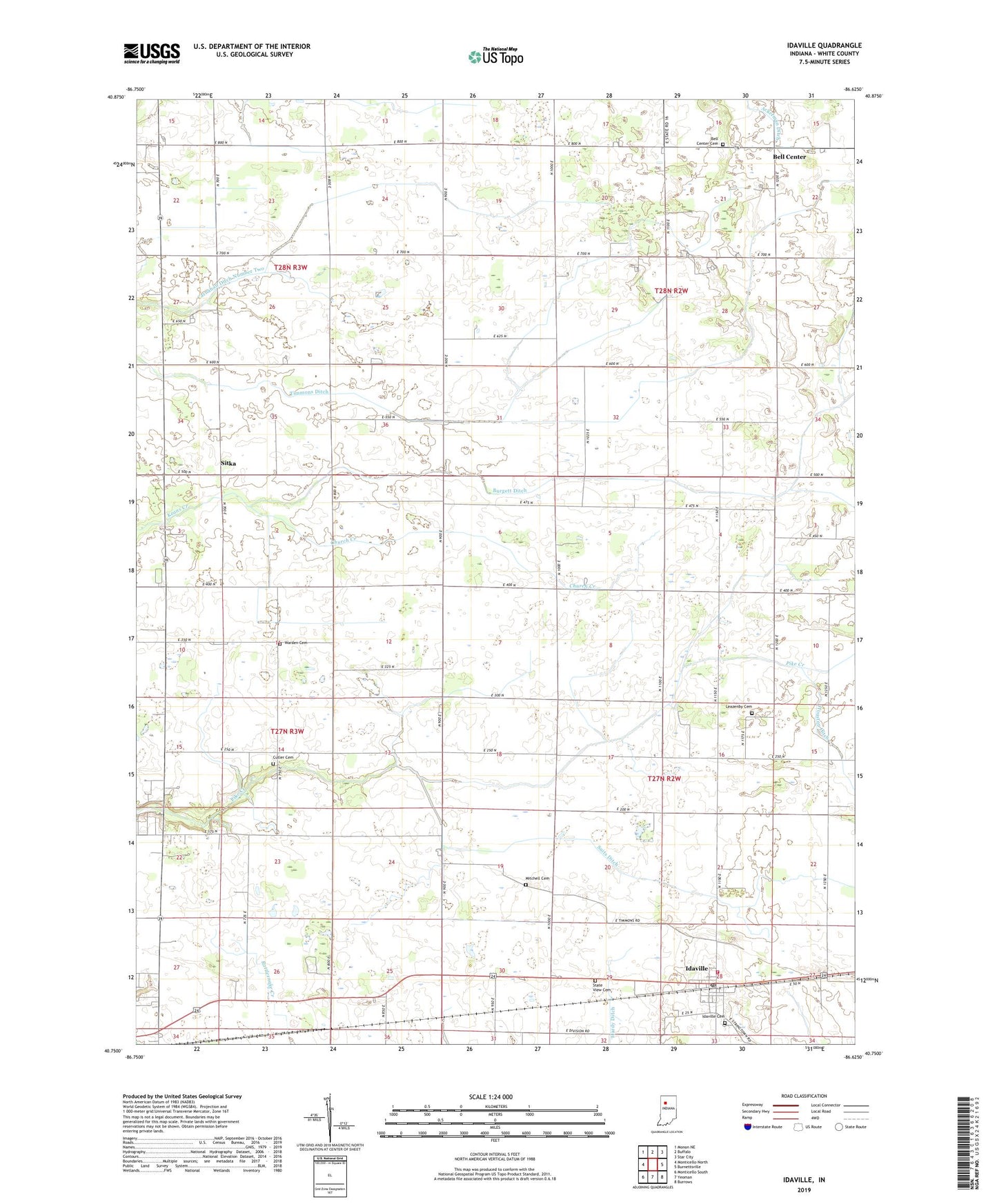
2022 topographic map quadrangle Idaville in the state of Indiana. Scale: 1:24000. Based on the newly updated USGS 7.5' US Topo map series, this map is in the following counties: White. The map contains contour data, water features, and other items you are used to seeing on USGS maps, but also has updated roads and other features. This is the next generation of topographic maps. Printed on high-quality waterproof paper with UV fade-resistant inks.
Quads adjacent to this one:
West: Monticello North
Northwest: Monon NE
North: Buffalo
Northeast: Star City
East: Burnettsville
Southeast: Burrows
South: Yeoman
Southwest: Monticello South
This map covers the same area as the classic USGS quad with code o40086g6.
Contains the following named places: Ackerman Ditch, Bell Center, Bell Center Cemetery, Burgett Ditch, Carnahan Ditch Number Two, Church Creek, Cutler Cemetery, Idaville, Idaville Cemetery, Idaville Census Designated Place, Idaville Post Office, Idaville Volunteer Fire Department, Leazenby Cemetery, Mitchell Cemetery, Pike Creek Church, Pious Chapel, Sitka, State View Cemetery, Suits Ditch, Three D Hog Farm, Timmons Ditch, Township of Cass, Township of Liberty, Township of Lincoln, Warden Cemetery, ZIP Code: 47950