MyTopo
Buffalo Indiana US Topo Map
Couldn't load pickup availability
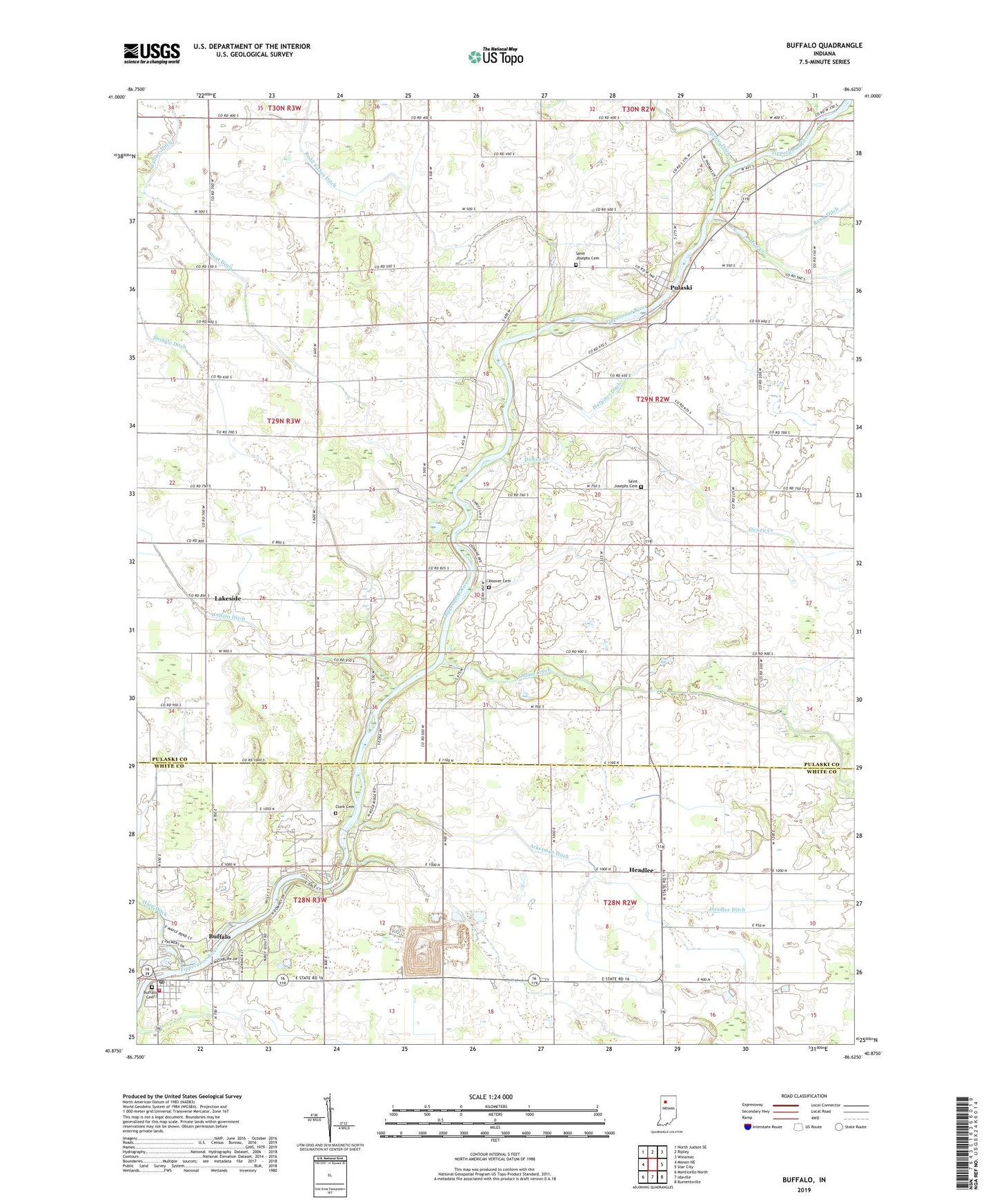
2022 topographic map quadrangle Buffalo in the state of Indiana. Scale: 1:24000. Based on the newly updated USGS 7.5' US Topo map series, this map is in the following counties: Pulaski, White. The map contains contour data, water features, and other items you are used to seeing on USGS maps, but also has updated roads and other features. This is the next generation of topographic maps. Printed on high-quality waterproof paper with UV fade-resistant inks.
Quads adjacent to this one:
West: Monon NE
Northwest: North Judson SE
North: Ripley
Northeast: Winamac
East: Star City
Southeast: Burnettsville
South: Idaville
Southwest: Monticello North
This map covers the same area as the classic USGS quad with code o40086h6.
Contains the following named places: Allen Airport, Budd Fisher Ditch, Buffalo, Buffalo Cemetery, Buffalo Census Designated Place, Buffalo Elementary School, Buffalo Liberty Township Volunteer Fire Department, Buffalo Post Office, Camp Buffalo, Clark Cemetery, Dickey Creek, Harpster Ditch, Headlee, Headlee Ditch, Hoover Cemetery, Indian Creek, Indian Creek Cemetery, Lakeside, Liberty Landfill, Mud Creek, Pauls Chapel, Pro Church, Pulaski, Radersdorf Ditch, Rawn Ditch, Saint Josephs Cemetery, Saint Josephs Church, Stout Ditch, Swingle Ditch, Tippecanoe Church, Township of Indian Creek, White Oak Church, ZIP Code: 47925