MyTopo
Monticello North Indiana US Topo Map
Couldn't load pickup availability
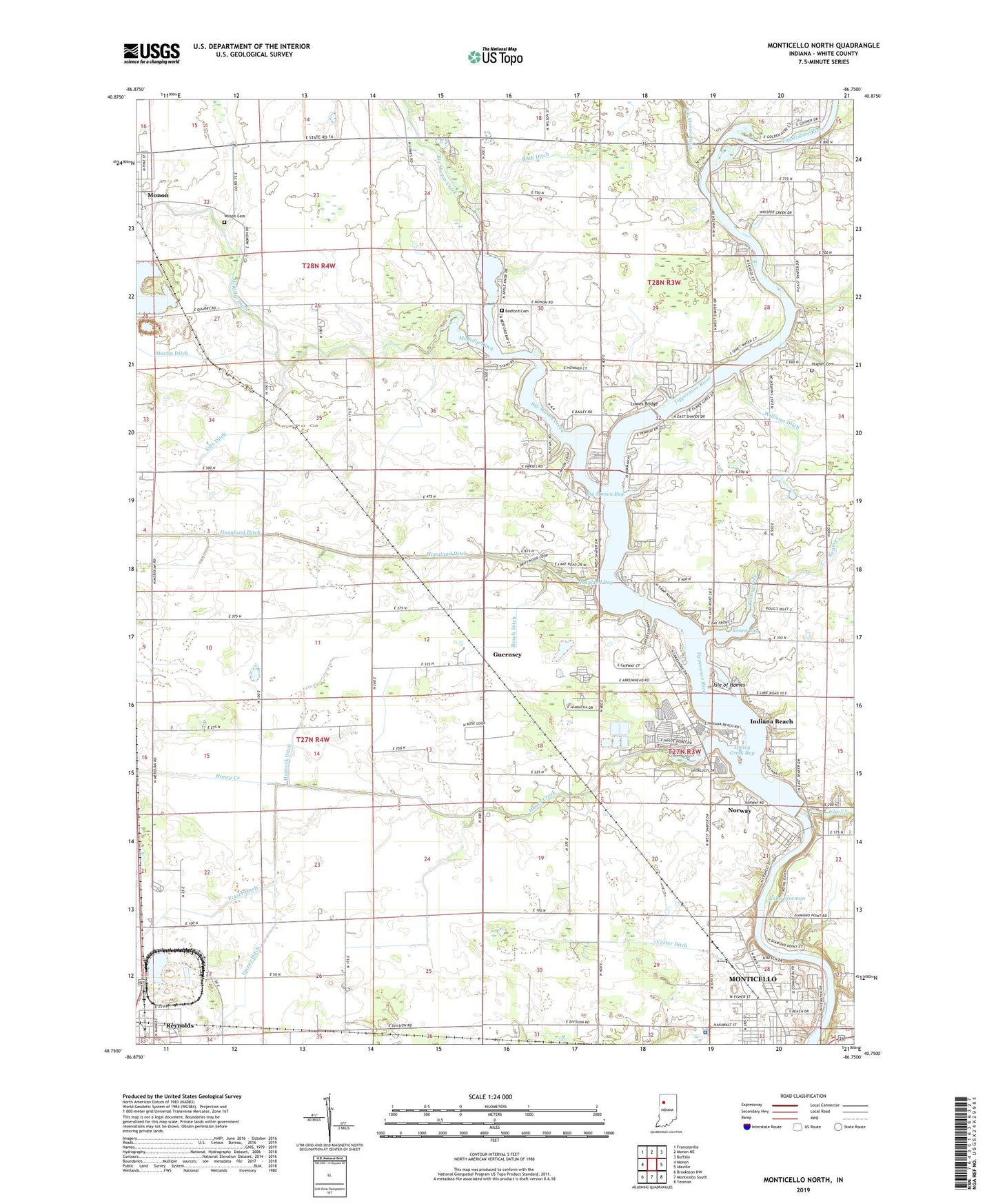
2022 topographic map quadrangle Monticello North in the state of Indiana. Scale: 1:24000. Based on the newly updated USGS 7.5' US Topo map series, this map is in the following counties: White. The map contains contour data, water features, and other items you are used to seeing on USGS maps, but also has updated roads and other features. This is the next generation of topographic maps. Printed on high-quality waterproof paper with UV fade-resistant inks.
Quads adjacent to this one:
West: Monon
Northwest: Francesville
North: Monon NE
Northeast: Buffalo
East: Idaville
Southeast: Yeoman
South: Monticello South
Southwest: Brookston NW
This map covers the same area as the classic USGS quad with code o40086g7.
Contains the following named places: Bedford Cemetery, Bedford Church, Beller McCollum Ditch, Big Monon Bay, Big Monon Creek, Carter Ditch, Diener Ditch, Guernsey, Guernsey Church, Hancock Ditch, Hoagland Bay, Honey Creek, Honey Creek Bay, Hughes Cemetery, Indiana Beach, Isle of Homes, Keans Bay, Keans Creek, Lake Shafer, Lake Shore Drive-In, Lakeview County Home, Lowes Bridge, Martin Ditch, Monon Chapel, Monon Elementary School, Norway, Norway Census Designated Place, Norway Dam, Pettit Ditch, Pike Creek, Roach Ditch, Ruth Ditch, Sills Ditch, Tippecanoe Country Club, Township of Honey Creek, Williams Ditch, Wilson Cemetery, Woodlawn Elementary School, Zion Church, ZIP Code: 47960