MyTopo
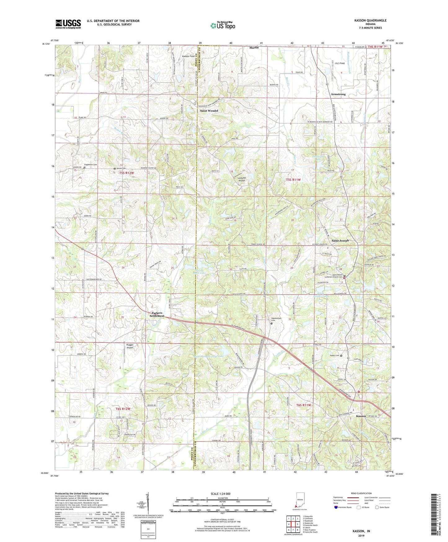
Kasson Indiana US Topo Map
Couldn't load pickup availability
2022 topographic map quadrangle Kasson in the state of Indiana. Scale: 1:24000. Based on the newly updated USGS 7.5' US Topo map series, this map is in the following counties: Vanderburgh, Posey. The map contains contour data, water features, and other items you are used to seeing on USGS maps, but also has updated roads and other features. This is the next generation of topographic maps. Printed on high-quality waterproof paper with UV fade-resistant inks.
Quads adjacent to this one:
West: Wadesville
Northwest: Poseyville
North: Cynthiana
Northeast: Haubstadt
East: Evansville North
Southeast: Evansville South
South: West Franklin
Southwest: Caborn
This map covers the same area as the classic USGS quad with code o38087a6.
Contains the following named places: Armstrong, Caney Creek, Crossroads, Cynthia Heights Elementary and Junior High School, Edgewater Lake, Edgewater Lake Dam, Engleheim Cemetery, German Township Fire Department Station 8, German Township Fire Department Station 9, Harold Mann Lake, Harold Mann Lake Dam, Higinbottom Cemetery, Huber Cemetery, J & S Field, Kasson, Koester Field, Kunze Cemetery, Lockyear Airport, Martin, Mater Dei Provincial Lake, Mater Dei Provincial Lake Dam, Memorial Church, North Estates Lake, North Lake Estates Lake Dam, Parkers Settlement, Parkers Settlement Census Designated Place, Plugger Airport, Raben Branch, Saint Joseph, Saint Pauls Church, Saint Peters Church, Saint Peters Lutheran Church Cemetery, Saint Wendel, Schnake Lake, Schnake Lake Dam, Slate Hill Church, Township of German, Township of Robinson, Wallenmeyer Ditch, Zoar Church, ZIP Code: 47720