MyTopo
Wadesville Indiana US Topo Map
Couldn't load pickup availability
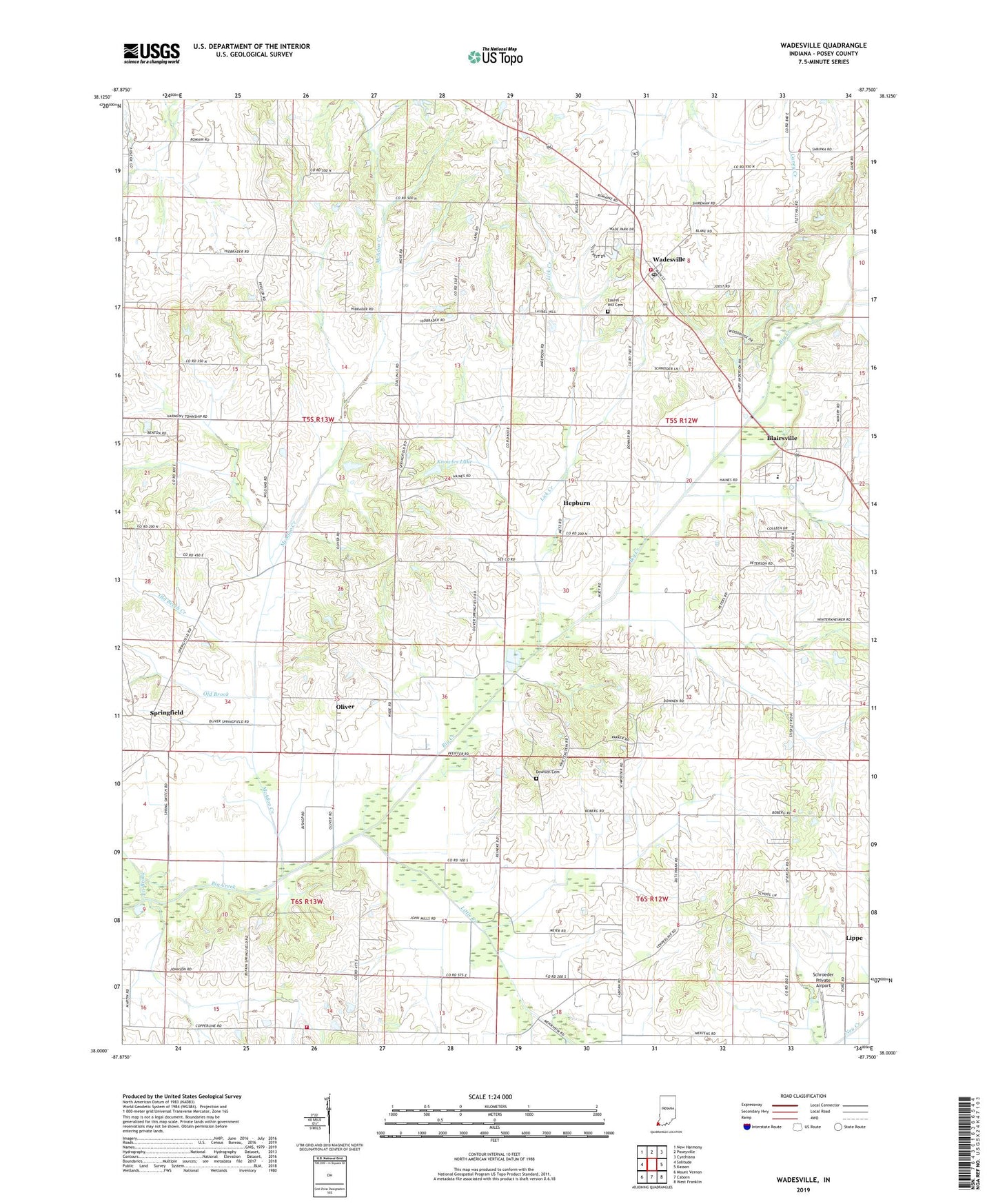
2022 topographic map quadrangle Wadesville in the state of Indiana. Scale: 1:24000. Based on the newly updated USGS 7.5' US Topo map series, this map is in the following counties: Posey. The map contains contour data, water features, and other items you are used to seeing on USGS maps, but also has updated roads and other features. This is the next generation of topographic maps. Printed on high-quality waterproof paper with UV fade-resistant inks.
Quads adjacent to this one:
West: Solitude
Northwest: New Harmony
North: Poseyville
Northeast: Cynthiana
East: Kasson
Southeast: West Franklin
South: Caborn
Southwest: Mount Vernon
This map covers the same area as the classic USGS quad with code o38087a7.
Contains the following named places: Black Township Fire and Rescue Station 2, Blairsville, Downen Cemetery, Hepburn, Knowles Lake, LaRoche Lake, Laurel Hill Cemetery, Lick Creek, Lippe, Little Creek, McAdoo Creek, Mount Zion Church, Old Beech Creek, Old Brook, Oliver, Oliver Underground Gas Storage Area, Posey County, Schroeder Private Airport, South Terrace Elementary School, Springfield, Stierley Airport, Township of Center, Tri Brook, Wadesville, Wadesville Center Township Volunteer Fire Department, Wadesville Post Office, ZIP Code: 47638