MyTopo
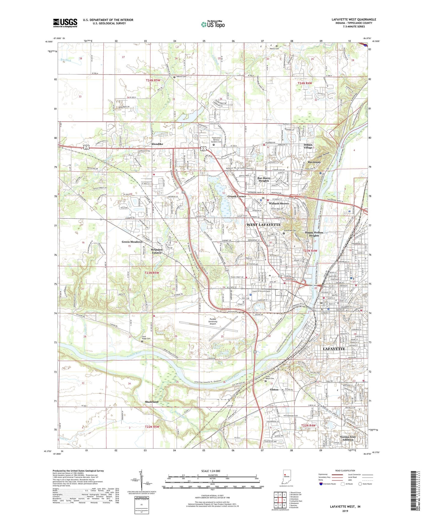
Lafayette West Indiana US Topo Map
Couldn't load pickup availability
2022 topographic map quadrangle Lafayette West in the state of Indiana. Scale: 1:24000. Based on the newly updated USGS 7.5' US Topo map series, this map is in the following counties: Tippecanoe. The map contains contour data, water features, and other items you are used to seeing on USGS maps, but also has updated roads and other features. This is the next generation of topographic maps. Printed on high-quality waterproof paper with UV fade-resistant inks.
Quads adjacent to this one:
West: Otterbein
Northwest: Round Grove
North: Brookston SW
Northeast: Brookston
East: Lafayette East
Southeast: Stockwell
South: Romney
Southwest: Westpoint
This map covers the same area as the classic USGS quad with code o40086d8.
Contains the following named places: Bar-Barry Heights, Cary Home for Children, Cedar Hollow, City of West Lafayette, Cole Ditch, Crumb Corner, Downtown Lafayette Post Office, Edgelea Elementary School, Elks Country Club, Elston, Franciscan Health Lafayette Central, Frank A Burtsfield Elementary School, George R Durgan Elementary School, Grandview Cemetery, Green Meadows, Hadley Lake, Happy Hollow, Happy Hollow Heights, Hebron Cemetery, Highland School, Indian Village, Indiana Veterans Home Cemetery, Jefferson Senior High School, Jordan Creek, Klondike, Klondike Elementary School, Klondike Junior High School, Lafayette, Lafayette Country Club, Lafayette Fire Department Station 1, Lafayette Fire Department Station 2, Lafayette Fire Department Station 3, Lafayette Fire Department Station 7, Lafayette Police Department, Linnwood Elementary School, McClure Ditch, McQuinn Estates, Morton Elementary School, Mount Zion Church, Norma Jean Addition, Ouiatenon Blockhouse, PHI Air Medical - Lafayette, Pierce Cemetery, Purdue University, Purdue University Agronomy Farm, Purdue University Airport, Purdue University Census Designated Place, Purdue University Dairy Farm, Purdue University Farm Center, Purdue University Fire Department, Purdue University Horticulture Farm, Purdue University Livestock Farm, Purdue University Poultry Farm, Purdue University Veterinarian Farm, Purdue Village Police Department, Ravinamy, Ross-Ade Stadium, Rush Airport, Saint Lawrence Convent, Saint Lawrence Elementary School, Saint Mary Cathedral School, Saint Marys Cemetery, Saint Vincent Seton Specialty Hospital Lafayette Campus, Sand Ridge Cemetery, Sharon Chapel, State Police Post Number 3, State Soldiers Home, Summit, Tippecanoe County, Tippecanoe County Sheriff's Office, Tippecanoe Memory Gardens Cemetery, Tippeecanoe School, Township of Wabash, Wabash Shores, Wabash Township Volunteer Fire Department Station 1, Wabash Township Volunteer Fire Department Station 2, Wabash Valley Hospital, Washington Elementary School, Wea Creek, Weaver Chapel, West Lafayette, West Lafayette Fire Department Station 1, West Lafayette Fire Department Station 2, West Lafayette Fire Department Station 3, West Lafayette Junior - Senior High School, West Lafayette Police Dept, West Lafayette Post Office, WXUS-FM (Lafayette), ZIP Codes: 47901, 47904, 47906, 47907


