MyTopo
Otterbein Indiana US Topo Map
Couldn't load pickup availability
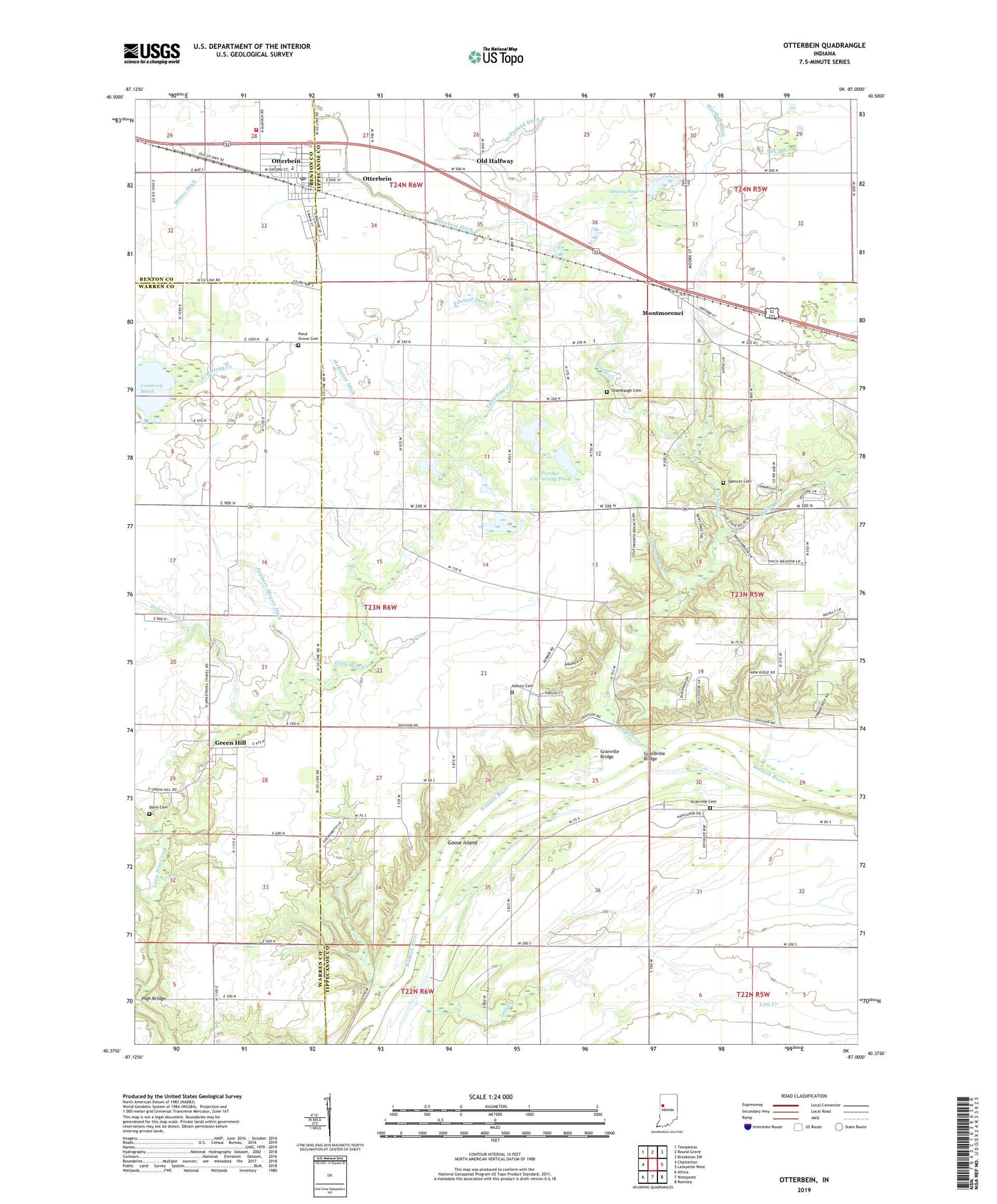
2022 topographic map quadrangle Otterbein in the state of Indiana. Scale: 1:24000. Based on the newly updated USGS 7.5' US Topo map series, this map is in the following counties: Tippecanoe, Warren, Benton. The map contains contour data, water features, and other items you are used to seeing on USGS maps, but also has updated roads and other features. This is the next generation of topographic maps. Printed on high-quality waterproof paper with UV fade-resistant inks.
Quads adjacent to this one:
West: Chatterton
Northwest: Templeton
North: Round Grove
Northeast: Brookston SW
East: Lafayette West
Southeast: Romney
South: Westpoint
Southwest: Attica
This map covers the same area as the classic USGS quad with code o40087d1.
Contains the following named places: Armstrong Chapel, Armstrong Creek, Asbury Cemetery, Bloomer's Greenhouse, Box Ditch, Colliers Island, Cranberry Marsh, Davis Cemetery, Edward Ditch, Gephart-Mageet Ditch, Goose Creek, Goose Island, Grandville Bridge, Granville Bridge, Granville Cemetery, Green Hill, Green Hill Census Designated Place, High Bridge, Indian Creek, Lost Creek, McFarland Ditch, McKinney Ditch, Montmorenci, Montmorenci Census Designated Place, Mulvey Pond, Old Halfway, Otterbein, Otterbein Ditch, Otterbein Elementary School, Otterbein Post Office, Otterbein Town Police Department, Otterbein Volunteer Fire Department, Pond Grove Cemetery, Purdue Experimental Farm, Purdue University Forest Laboratory, Purdue University Pond, Ross Camp, Saint Pauls Church, Shambaugh Cemetery, Southworth Branch, Spencer Cemetery, Town of Otterbein, Township of Shelby