MyTopo
Romney Indiana US Topo Map
Couldn't load pickup availability
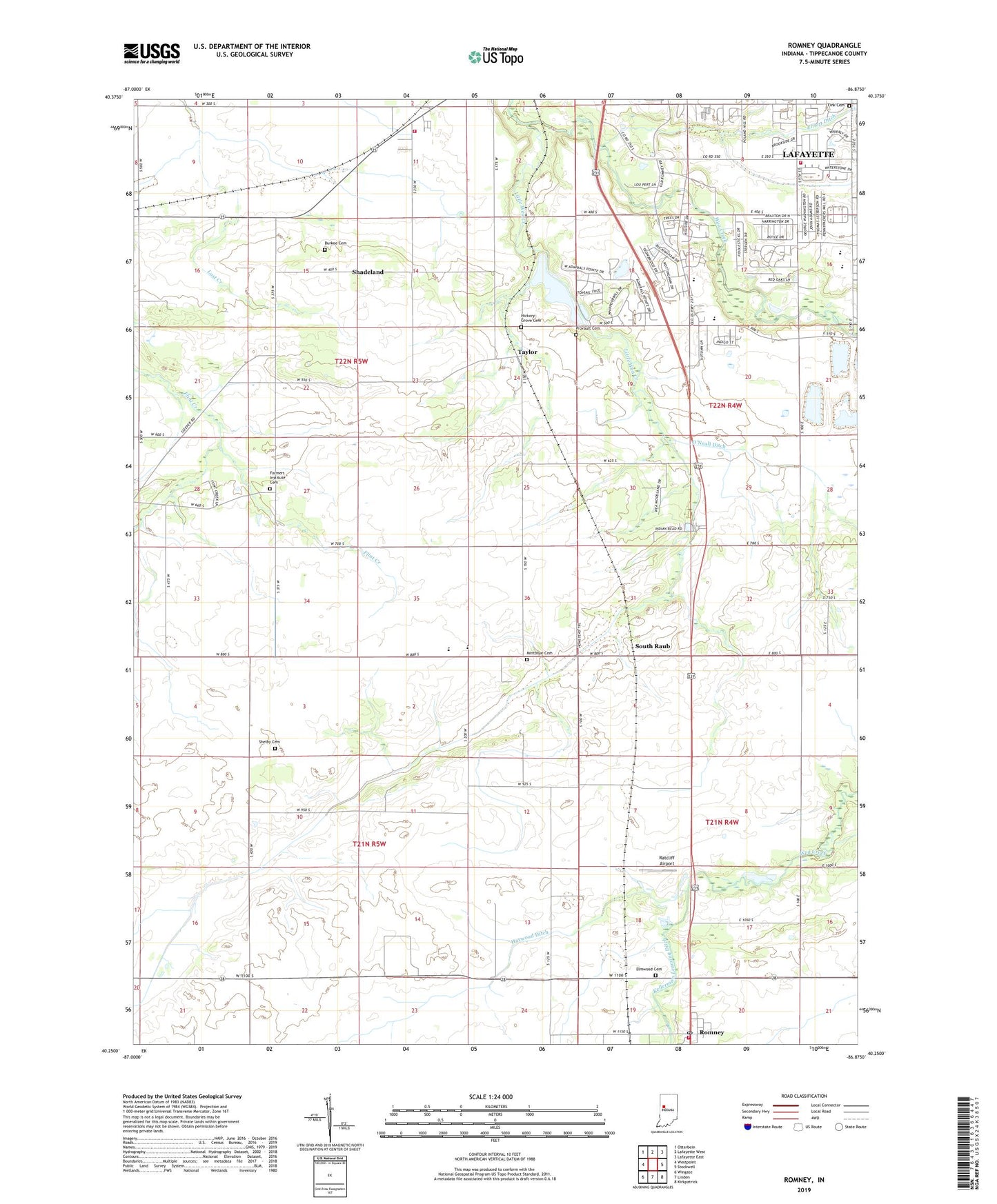
2022 topographic map quadrangle Romney in the state of Indiana. Scale: 1:24000. Based on the newly updated USGS 7.5' US Topo map series, this map is in the following counties: Tippecanoe. The map contains contour data, water features, and other items you are used to seeing on USGS maps, but also has updated roads and other features. This is the next generation of topographic maps. Printed on high-quality waterproof paper with UV fade-resistant inks.
Quads adjacent to this one:
West: Westpoint
Northwest: Otterbein
North: Lafayette West
Northeast: Lafayette East
East: Stockwell
Southeast: Kirkpatrick
South: Linden
Southwest: Wingate
This map covers the same area as the classic USGS quad with code o40086c8.
Contains the following named places: Agricultural Seed Airstrip, Corwin, Durkee Cemetery, Elmwood Cemetery, Fairfield Pit, Farmers Institute Cemetery, Farmers Institute Church, Fink Cemetery, Haywood Ditch, Hickory Grove Cemetery, Kellerman Leaming Ditch, Lafayette Fire Department Station 8, Mintonye Cemetery, Montgomery Ditch, O'Neall Ditch, Provault Cemetery, Randolph Township Volunteer Fire Department, Ratcliff Airport, Romney Census Designated Place, Romney Post Office, Shadeland, Shadeland School, Shadeland Volunteer Fire Department, Shelby Cemetery, South Raub, Southwestern Junior High School, Stidham Church, Taylor, Town of Shadeland, Township of Randolph, Township of Union, WBAA-AM (West Lafayette), WFTE-AM (Lafayette), ZIP Code: 47909