MyTopo
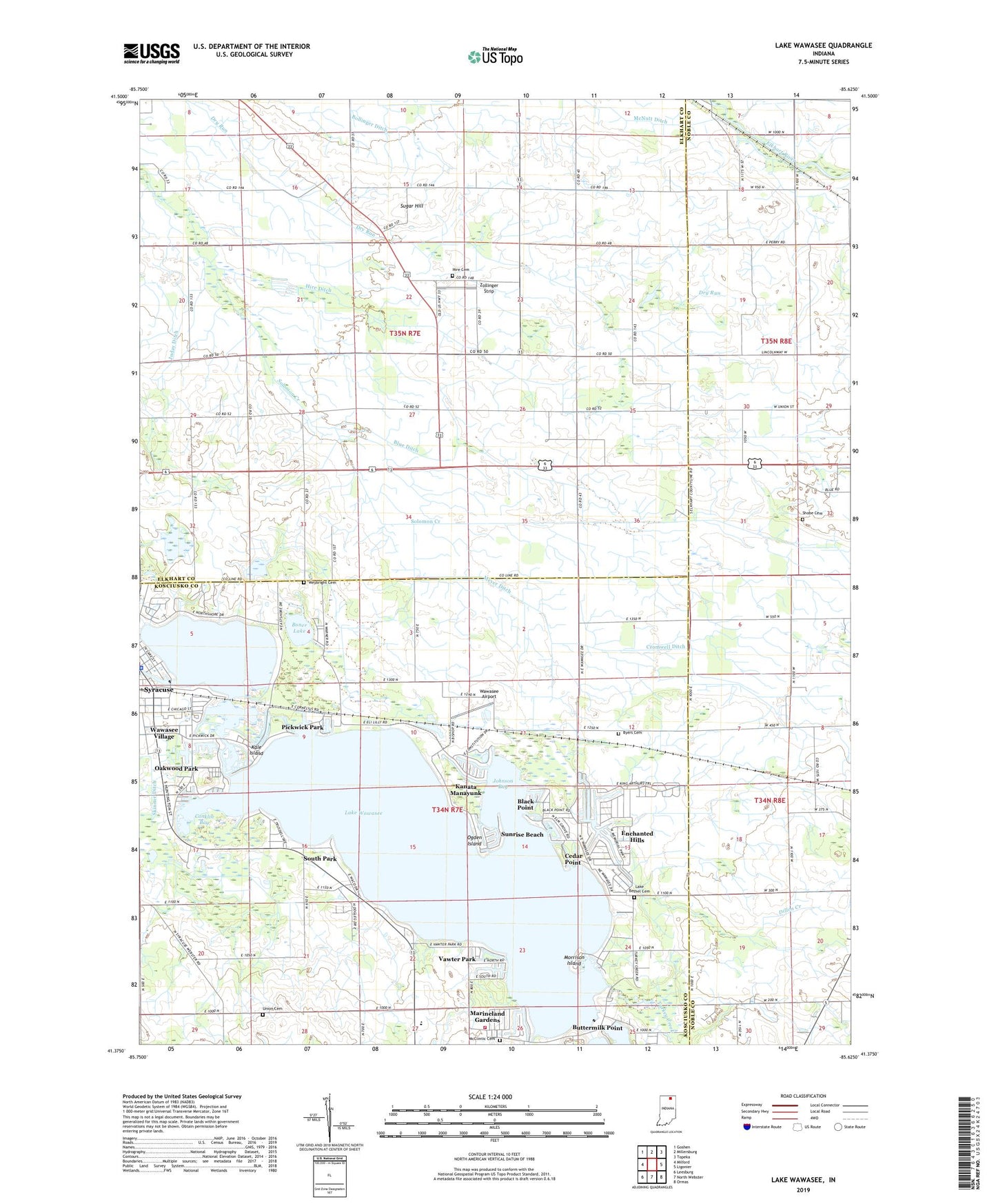
Lake Wawasee Indiana US Topo Map
Couldn't load pickup availability
2022 topographic map quadrangle Lake Wawasee in the state of Indiana. Scale: 1:24000. Based on the newly updated USGS 7.5' US Topo map series, this map is in the following counties: Kosciusko, Elkhart, Noble. The map contains contour data, water features, and other items you are used to seeing on USGS maps, but also has updated roads and other features. This is the next generation of topographic maps. Printed on high-quality waterproof paper with UV fade-resistant inks.
Quads adjacent to this one:
West: Milford
Northwest: Goshen
North: Millersburg
Northeast: Topeka
East: Ligonier
Southeast: Ormas
South: North Webster
Southwest: Leesburg
This map covers the same area as the classic USGS quad with code o41085d6.
Contains the following named places: Black Point, Blue Ditch, Bollinger Ditch, Boner Lake, Buttermilk Point, Byers Cemetery, Cedar Point, Church of the Little Flower, Conklin Bay, Cromwell Ditch, Dillon Creek, Enchanted Hills, Grismore, Hex School, Hire Cemetery, Hire Ditch, Johnson Bay, Juday Ditch, Juday School, Kale Island, Kanata Manayunk, Lake Bethel Cemetery, Lake Wawasee, Lakeside Chapel, Lakeview Park, Long Ditch, Marineland Gardens, Maxwelton Golf Club, McClintic Cemetery, McNutt Ditch, Meyer Ditch, Morrison Island, Oakwood Park, Ogden Island, Our Lady of the Lake Seminary, Papakeechie Lake Dam, Pickwick Park, Richville Church, Sand Point, Shobe Cemetery, Solomon Creek, South Park, South Shore Golf Club, Sugar Hill, Sunrise Beach, Syracuse Lake, Syracuse Police Department, Town of Syracuse, Township of Benton, Township of Turkey Creek, Turkey Creek Fire Territory Station 2, Union Cemetery, Vawter Park, Wawasee, Wawasee Airport, Wawasee Golf Club, Wawasee Post Office, Wawasee Public Fishing Area, Wawasee State Fish Hatchery, Wawasee Village, Weybright Cemetery, Zion Church, Zollinger Strip, ZIP Code: 46567