MyTopo
Leesburg Indiana US Topo Map
Couldn't load pickup availability
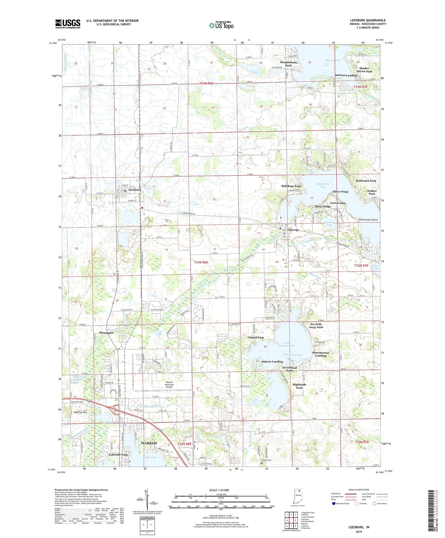
2022 topographic map quadrangle Leesburg in the state of Indiana. Scale: 1:24000. Based on the newly updated USGS 7.5' US Topo map series, this map is in the following counties: Kosciusko. The map contains contour data, water features, and other items you are used to seeing on USGS maps, but also has updated roads and other features. This is the next generation of topographic maps. Printed on high-quality waterproof paper with UV fade-resistant inks.
Quads adjacent to this one:
West: Atwood
Northwest: Nappanee East
North: Milford
Northeast: Lake Wawasee
East: North Webster
Southeast: Pierceton
South: Warsaw
Southwest: Burket
This map covers the same area as the classic USGS quad with code o41085c7.
Contains the following named places: Arrowhead Park, Bell Rohr Park, Big Chapman Lake, Cable Run, Deeds Creek, DeFries Landing, Dewart Lake, Forest Glen, Garber Field, Government Point, Groves Cemetery, Heeter Ditch, Hickman Ditch, Highlands Park, Island Park, Kalorama Park, Kohler Ditch, Lakeside Park, Leesburg, Leesburg Elementary School, Leesburg Post Office, Little Chapman Lake, Little Pike Lake, Lones Ditch, Long Ditch, McElroy Hill, Monoquet, Musquabuck Park, New Salem Church, Old Channel Kankakee River, Osborn Landing, Oswego, Oswego Lake, Otis R Bowen Center for Human Services Intake Center, Patona Bay, Pike Lake, Plain Township Leesburg Volunteer Fire Department, Potawatomi Park, Quaker Haven Park, Ruple Ditch, Silver Point, Stanton Lake, Stoneburner Landing, Stony Ridge, Tippecanoe Country Club, Tippecanoe Lake, Town of Leesburg, Township of Plain, Walker Park, Warsaw Municipal Airport, Wa-Will-Away Park, Westlake Ditch, ZIP Codes: 46538, 46582