MyTopo
Milford Indiana US Topo Map
Couldn't load pickup availability
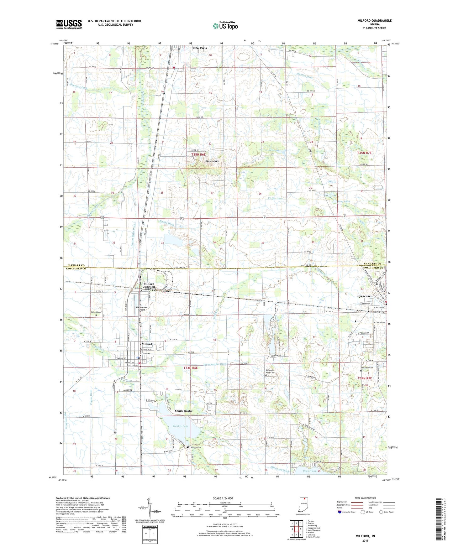
2022 topographic map quadrangle Milford in the state of Indiana. Scale: 1:24000. Based on the newly updated USGS 7.5' US Topo map series, this map is in the following counties: Kosciusko, Elkhart. The map contains contour data, water features, and other items you are used to seeing on USGS maps, but also has updated roads and other features. This is the next generation of topographic maps. Printed on high-quality waterproof paper with UV fade-resistant inks.
Quads adjacent to this one:
West: Nappanee East
Northwest: Foraker
North: Goshen
Northeast: Millersburg
East: Lake Wawasee
Southeast: North Webster
South: Leesburg
Southwest: Atwood
This map covers the same area as the classic USGS quad with code o41085d7.
Contains the following named places: Bethany School, Buzzard Hill, Camp Alexander Mack, Concord Church, Coppes Ditch, Dry Run, Frog Pond, H R Weisser Airport, Hammond Ditch, Hoopingarner Ditch, Jackson Township Emergency Ambulance Service, Kieffer Ditch, Lakeside Cemetery, Maple Grove Church, Matthews Farms, Milford, Milford Cemetery, Milford Elementary School, Milford Junction, Milford Junior High School, Milford Police Department, Milford Post Office, Milford Volunteer Fire Department, Multiple Township Emergency Medical Services - Milford, New Paris Fire Department, New Paris Post Office, Pleasant View Cemetery, Preston Miles Ditch, Redmon Park, Shady Banks, Skinner Ditch, Snider Farms, Solomon Creek Church, Syracuse, Syracuse Elementary School, Syracuse Junior High School, Syracuse Post Office, Tamarack Cemetery, Town of Milford, Township of Jackson, Township of Van Buren, Turkey Creek Fire Territory Station 1, WAKE-AM (Valparaiso), Waubee Lake, Wawasee High School, Whetten Ditch, Worley Ditch, Zimmerman Gravel Pit, ZIP Codes: 46542, 46553