MyTopo
Topeka Indiana US Topo Map
Couldn't load pickup availability
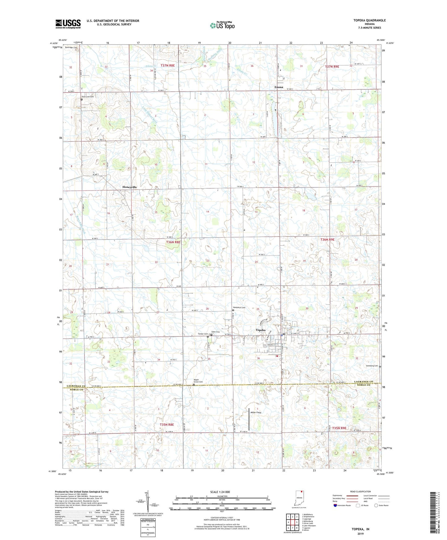
2022 topographic map quadrangle Topeka in the state of Indiana. Scale: 1:24000. Based on the newly updated USGS 7.5' US Topo map series, this map is in the following counties: LaGrange, Noble. The map contains contour data, water features, and other items you are used to seeing on USGS maps, but also has updated roads and other features. This is the next generation of topographic maps. Printed on high-quality waterproof paper with UV fade-resistant inks.
Quads adjacent to this one:
West: Millersburg
Northwest: Middlebury
North: Shipshewana
Northeast: Lagrange
East: Oliver Lake
Southeast: Albion
South: Ligonier
Southwest: Lake Wawasee
This map covers the same area as the classic USGS quad with code o41085e5.
Contains the following named places: Bontrager Ditch, Byler Ditch, Eden Cemetery, Emma, Emma Creek, Emma Lake, Erb Ditch, Gerber Cemetery, Hawpatch Cemetery, Honeyville, Honeyville Elementary School, Little Elkhart River Ditch, Maple Grove Cemetery, Miller Field, Poynter School, Salem Church, Steinberg Cemetery, Topeka, Topeka Elementary School, Topeka Police Department, Topeka Post Office, Topeka Volunteer Fire Department, Town Line Cemetery, Town Line Church, Town of Topeka, Township of Eden, Walnut School, Westview Junior-Senior High School, Wortinger School, Yoder Airport, ZIP Code: 46571