MyTopo
Lewisville Indiana US Topo Map
Couldn't load pickup availability
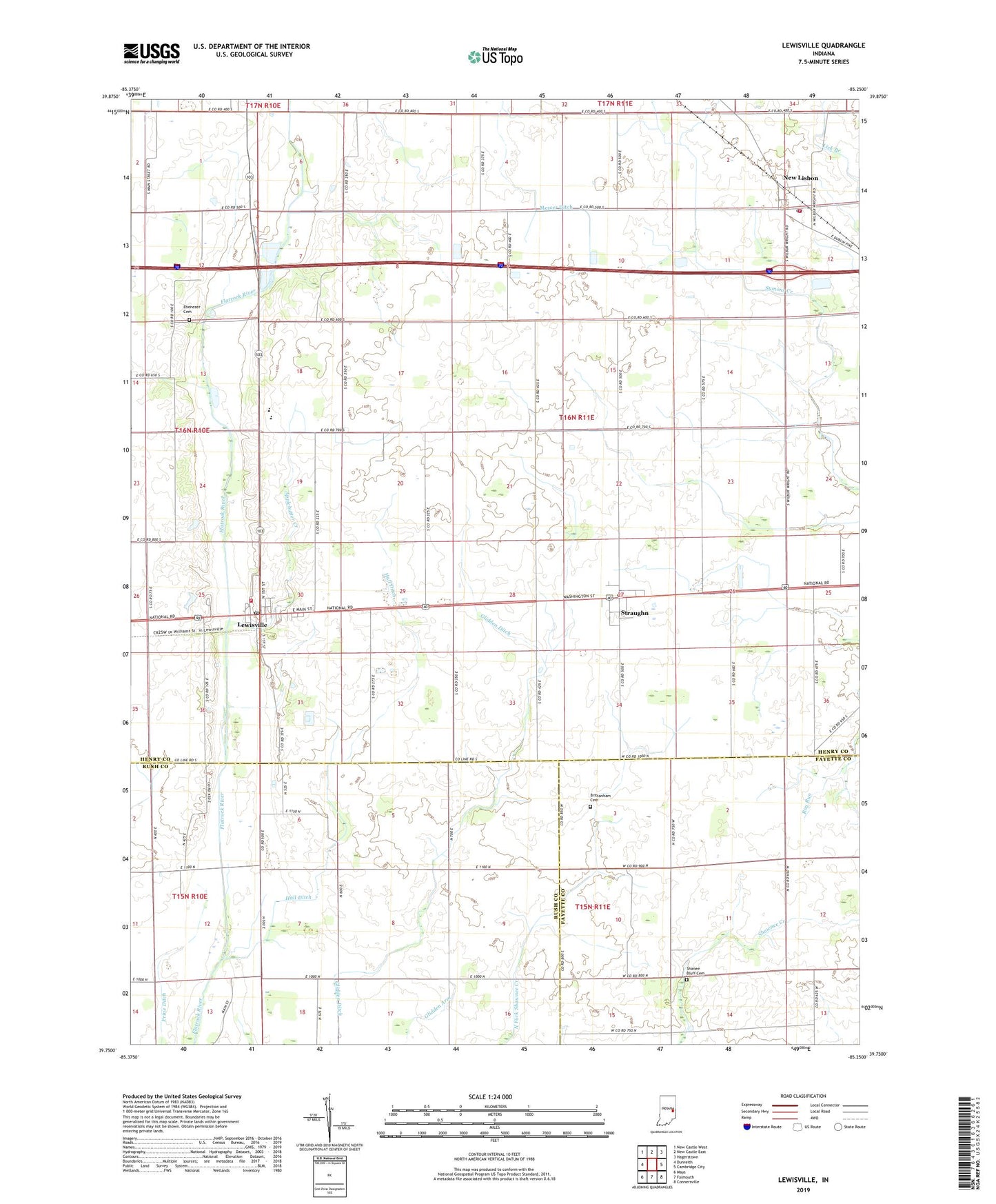
2022 topographic map quadrangle Lewisville in the state of Indiana. Scale: 1:24000. Based on the newly updated USGS 7.5' US Topo map series, this map is in the following counties: Henry, Rush, Fayette. The map contains contour data, water features, and other items you are used to seeing on USGS maps, but also has updated roads and other features. This is the next generation of topographic maps. Printed on high-quality waterproof paper with UV fade-resistant inks.
Quads adjacent to this one:
West: Dunreith
Northwest: New Castle West
North: New Castle East
Northeast: Hagerstown
East: Cambridge City
Southeast: Connersville
South: Falmouth
Southwest: Mays
This map covers the same area as the classic USGS quad with code o39085g3.
Contains the following named places: Applebutter Creek, Brittanham Cemetery, Ebenezer Cemetery, Ebenezer Church, Hall Ditch, Hopewell Church, Lewisville, Lewisville Post Office, Lewisville Volunteer Fire Department, New Castle-Henry County Municipal Airport, New Lisbon, New Lisbon Community Volunteer Fire Department, New Lisbon Post Office, Rich Square Church, Salem Church, Shanee Bluff Cemetery, Straughn, Straughn Post Office, Straughn Volunteer Fire Department, Town of Lewisville, Town of Straughn, Township of Dudley, Township of Franklin, Tri Junior-Senior High School, ZIP Codes: 47352, 47387