MyTopo
Falmouth Indiana US Topo Map
Couldn't load pickup availability
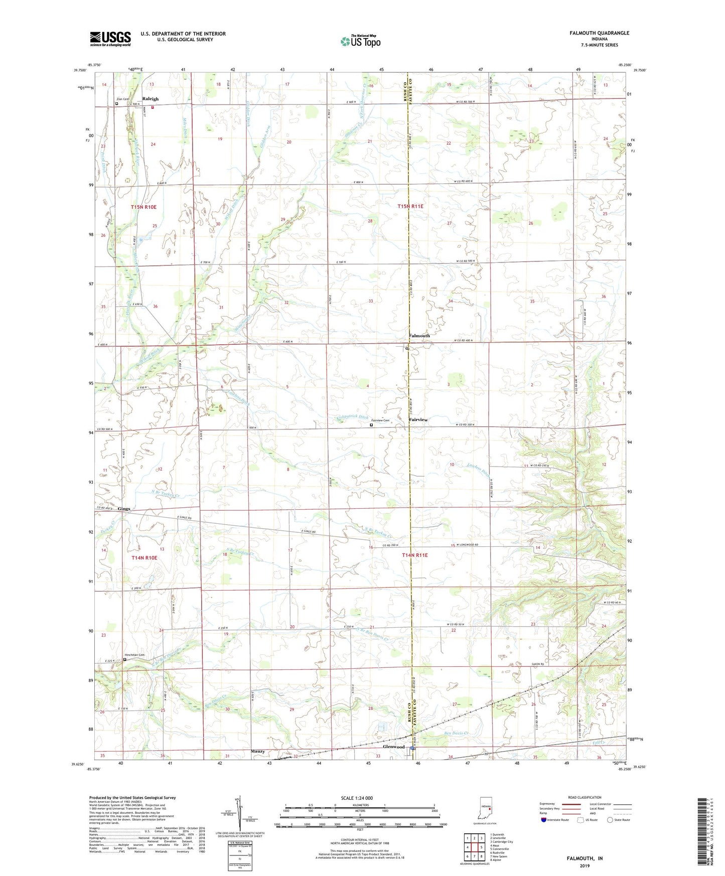
2022 topographic map quadrangle Falmouth in the state of Indiana. Scale: 1:24000. Based on the newly updated USGS 7.5' US Topo map series, this map is in the following counties: Rush, Fayette. The map contains contour data, water features, and other items you are used to seeing on USGS maps, but also has updated roads and other features. This is the next generation of topographic maps. Printed on high-quality waterproof paper with UV fade-resistant inks.
Quads adjacent to this one:
West: Mays
Northwest: Dunreith
North: Lewisville
Northeast: Cambridge City
East: Connersville
Southeast: Alpine
South: New Salem
Southwest: Rushville
This map covers the same area as the classic USGS quad with code o39085f3.
Contains the following named places: Ben Davis Creek Church, Dungan Airport, Fairview, Fairview Cemetery, Falmouth, Falmouth Post Office, Frazee Elementary School, Gings, Glenwood, Glenwood Police Department, Glenwood Post Office, Glidden Arm, Glidden Ditch, Hinchman Cemetery, Kirkpatrick Ditch, Lawless Ditch, Mahoning Valley Camp, Miles Ditch, North Branch Ben Davis Creek, North Branch Turkey Creek, North Fork Shawnee Creek, Plum Creek Church, Prine Ditch, Raleigh, Raleigh Fire Department Station 1, Shaker Run, Shawnee Creek, South Branch Turkey Creek, Town of Glenwood, Township of Fairview, Township of Union, Township of Washington, Wikoff Ditch, Zion Cemetery, ZIP Code: 46127