MyTopo
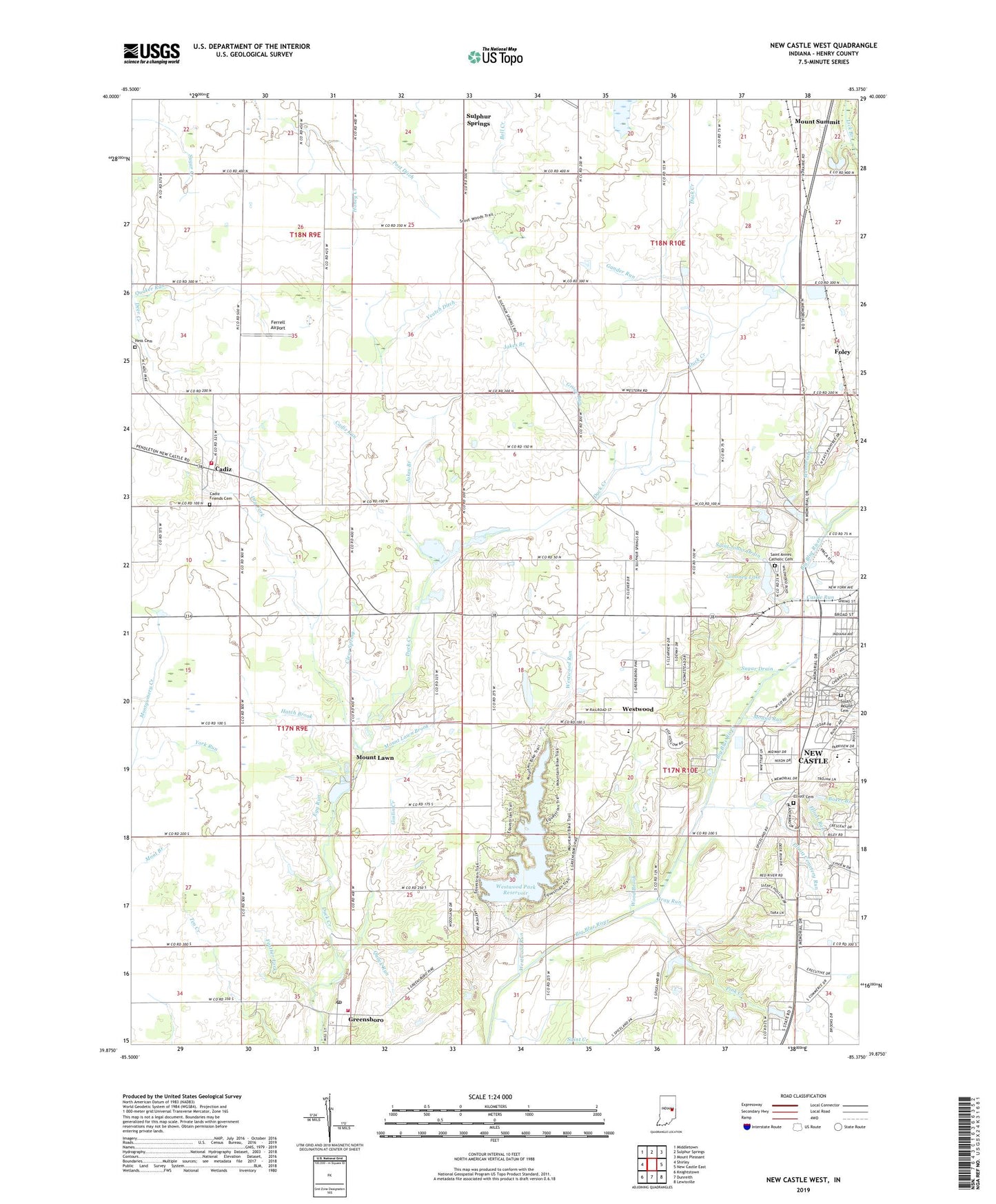
New Castle West Indiana US Topo Map
Couldn't load pickup availability
2022 topographic map quadrangle New Castle West in the state of Indiana. Scale: 1:24000. Based on the newly updated USGS 7.5' US Topo map series, this map is in the following counties: Henry. The map contains contour data, water features, and other items you are used to seeing on USGS maps, but also has updated roads and other features. This is the next generation of topographic maps. Printed on high-quality waterproof paper with UV fade-resistant inks.
Quads adjacent to this one:
West: Shirley
Northwest: Middletown
North: Sulphur Springs
Northeast: Mount Pleasant
East: New Castle East
Southeast: Lewisville
South: Dunreith
Southwest: Knightstown
This map covers the same area as the classic USGS quad with code o39085h4.
Contains the following named places: Baker Branch, Baker Park, Bone Run, Cadiz, Cadiz - Harrison Township Volunteer Fire Department, Cadiz Friends Cemetery, Cadiz Run, Castle Run, Clear Spring, Clear Spring Church, Dark Run, Down Run, Dry Fork, Egg Run, Elliott Cemetery, Elliott Cemetery Run, Elliott Run, Fayne Siding, Feather Fork, Ferrell Airport, Foley, Gander Run, Giboney Lake, Giboney Lake Dam, Goose Run, Goslin Creek, Greensboro, Greensboro Post Office, Greensboro Volunteer Fire Department, Greenstreet Elementary School, Grove Run, Hatch Brook, Henry County, Hess Cemetery, Jakes Branch, Memorial Creek, Memorial Park, Mound Run, Mount Lawn, Mount Lawn Brook, Mount Zion Church, New Castle Chrysler High School, Parkview Junior High B-7 Building, Parkview Junior High School, Pink Creek, Post Ditch, Quack Run, Quaker Run, Quill Run, Saint Annes Catholic Cemetery, Saint Creek, Saint Johns Drain, Shively Park, Sky Run, South Mound Cemetery, Sugar Drain, Sugar Grove Church, Sugar Grove School, Town of Cadiz, Town of Greensboro, Town of Sulphur Springs, Township of Henry, Upper Big Blue Structure Number 14, Veatch Ditch, WCTW-AM (New Castle), Web Run, West Leg Westwood Run, Westwood, Westwood Park Reservoir, Westwood Run, Whittier Lane Church, Wood Brook, York Run, ZIP Code: 47344